
1954 Map of Lime Hills B-3
USGS Topo · Published 1965About this map
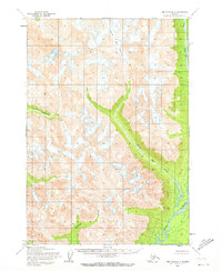
The Stony River corridor dominates this interior Alaskan landscape, serving as the primary drainage for the high-altitude terrain in the Lime Hills region. Moving through the eastern edge of the quadrangle, the river receives glacial meltwater from a system of valleys carved by ice and runoff. The Tired Pup Glacier feeds into Tired Pup Creek, which flows southeast to join the main river channel. To the west, Little Underhill Creek cuts through the high ridges, illustrating the drainage patterns of an unsurveyed wilderness. The map provides a look at the topography as it was understood in the mid-1950s, with many land lines predetermined by the Bureau of Land Management rather than marked on the ground.
Find a feature on this map
5 named features on this map. Tap any name to fly to it.
Don’t see what you’re looking for? This feature index may not catch every label — zoom into the map to look around manually.
Map Details
Editions of this 1954 Lime Hills B-3 Map
2 editions found
Other maps of this area

1951 · Lime Hills
USGS Topo · 1:250,000

1954 · Lime Hills A-3
USGS Topo · 1:63,360

1954 · Lime Hills B-4
USGS Topo · 1:63,360

1954 · Lime Hills A-4
USGS Topo · 1:63,360

1958 · Lime Hills A-2
USGS Topo · 1:63,360

1958 · Lime Hills C-3
USGS Topo · 1:63,360

1958 · Lime Hills C-2
USGS Topo · 1:63,360

1958 · Lime Hills C-4
USGS Topo · 1:63,360
1958 · Lime Hills B-2
USGS Topo · 1:63,360

1958 · Lime Hills
USGS Topo · 1:250,000