
1954 Map of Lime Hills A-4
USGS Topo · Published 1965About this map
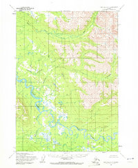
The Stony River winds through this Alaskan interior landscape, creating a complex network of meanders and oxbow lakes that dominate the southwestern portion of the sheet. This mid-century survey by the Army Map Service reveals an area defined by its drainage systems, where Tedaquana Creek joins the main river flow amidst low-lying marshes. To the north and east, the terrain rises sharply into the Eagle Mountains, which channel several smaller waterways including Eagle Creek and Tuukaleshna Creek. These features illustrate the natural hydrology of the Seward Meridian before later development or environmental shifts. The map represents a specific era of photogrammetric mapping, using aerial photography from the late 1950s to document a wilderness region that remained largely unsurveyed on the ground by the Bureau of Land Management.
Find a feature on this map
6 named features on this map. Tap any name to fly to it.
Don’t see what you’re looking for? This feature index may not catch every label — zoom into the map to look around manually.
Map Details
Editions of this 1954 Lime Hills A-4 Map
2 editions found
Other maps of this area

1946 · Lake Clark
USGS Topo · 1:250,000

1951 · Lake Clark
USGS Topo · 1:250,000

1951 · Lime Hills
USGS Topo · 1:250,000

1954 · Lime Hills A-5
USGS Topo · 1:63,360

1954 · Lime Hills A-3
USGS Topo · 1:63,360

1954 · Lime Hills B-4
USGS Topo · 1:63,360

1954 · Lake Clark D-3
USGS Topo · 1:63,360

1954 · Lime Hills B-5
USGS Topo · 1:63,360

1954 · Lime Hills B-3
USGS Topo · 1:63,360

1954 · Lake Clark D-5
USGS Topo · 1:63,360