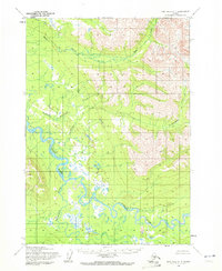
1954 Map of Lime Hills A-4
USGS Topo · Published 1972About this map
Stony River meanders across this mid-century Alaskan interior landscape, joined by the Telaquana River in a complex network of braids and oxbow lakes. This terrain, documented by the Army Map Service in the early 1950s, reveals a wild drainage system where Tunkalashna Creek and Eagle Mountain Creek feed into the broader valley from the surrounding heights. Distinctive landmarks such as Necong and Slope provide navigational reference points in an area defined by its hydrology rather than human infrastructure. The lack of roads or established trails on the sheet emphasizes the isolation of the Lime Hills region during this era, making it an essential reference for understanding the natural state of the Rock Creek watershed before later development or environmental changes altered these watercourses.
Find a feature on this map
8 named features on this map. Tap any name to fly to it.
Don’t see what you’re looking for? This feature index may not catch every label — zoom into the map to look around manually.
Map Details
Editions of this 1954 Lime Hills A-4 Map
2 editions found
Other maps of this area

1946 · Lake Clark
USGS Topo · 1:250,000

1951 · Lake Clark
USGS Topo · 1:250,000

1951 · Lime Hills
USGS Topo · 1:250,000

1954 · Lime Hills A-5
USGS Topo · 1:63,360

1954 · Lime Hills A-3
USGS Topo · 1:63,360

1954 · Lime Hills B-4
USGS Topo · 1:63,360

1954 · Lake Clark D-3
USGS Topo · 1:63,360

1954 · Lime Hills A-4
USGS Topo · 1:63,360

1954 · Lime Hills B-5
USGS Topo · 1:63,360

1954 · Lime Hills B-3
USGS Topo · 1:63,360