
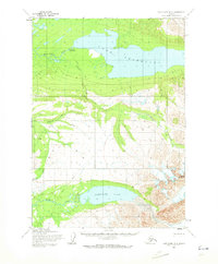
1954 Map of Lake Clark D-3
USGS Topo · Published 1965About this map
Lake Telaquana and the surrounding wilderness in the Lake Clark region are documented here during the mid-1950s. The presence of Old Village (Abandoned) along the north shore of the lake suggests a shifting settlement pattern, where an established community once relied on the proximity of the Telaquana River. This landscape is defined by its glacial waters and natural corridors, specifically the Native Trail which follows the drainage from Summit Creek down toward the southern waters of Turquoise Lake. The topography, rising toward the prominent Telaquana Mountain, reveals a territory where movement was dictated by river valleys and established footpaths rather than roads. The Mulchatna River system in the southwest completes a picture of a remote subarctic environment captured just before modern changes reached the Alaskan interior.
Find a feature on this map
9 named features on this map. Tap any name to fly to it.
Don’t see what you’re looking for? This feature index may not catch every label — zoom into the map to look around manually.
Map Details
Editions of this 1954 Lake Clark D-3 Map
2 editions found
Other maps of this area

1946 · Lake Clark
USGS Topo · 1:250,000

1951 · Lake Clark
USGS Topo · 1:250,000

1951 · Lime Hills
USGS Topo · 1:250,000

1954 · Lake Clark C-3
USGS Topo · 1:63,360

1954 · Lake Clark C-4
USGS Topo · 1:63,360

1954 · Lime Hills A-3
USGS Topo · 1:63,360

1954 · Lime Hills A-4
USGS Topo · 1:63,360

1954 · Lake Clark D-4
USGS Topo · 1:63,360

1958 · Lime Hills A-2
USGS Topo · 1:63,360
1958 · Lake Clark D-2
USGS Topo · 1:63,360