
1954 Map of Lake Clark C-3
USGS Topo · Published 1964About this map
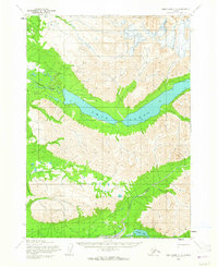
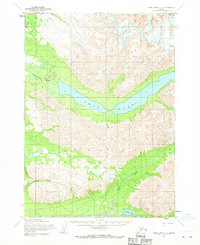
Twin Lakes dominates the center of this 1950s survey, illustrating the hydrography of the Lake Clark region before later developments altered the remote landscape. The map captures the significant drainage patterns of the Chilikadrotna River flowing from the western waters, and the Kijik River winding through the southeastern terrain toward Portage Lake. A notable Native Trail is marked in the northwestern corner, providing a rare piece of cartographic evidence for traditional overland travel routes through the mountain passes of the era. The land forms are defined by sharp contour intervals that reflect the glaciated valleys and high-altitude basins typical of this part of Alaska, offering a detailed record for those studying the physical geography or historical travel patterns of the interior.
Find a feature on this map
5 named features on this map. Tap any name to fly to it.
Don’t see what you’re looking for? This feature index may not catch every label — zoom into the map to look around manually.
Map Details
Editions of this 1954 Lake Clark C-3 Map
3 editions found
Other maps of this area

1946 · Lake Clark
USGS Topo · 1:250,000

1951 · Lake Clark
USGS Topo · 1:250,000

1954 · Lake Clark C-4
USGS Topo · 1:63,360

1954 · Lake Clark D-3
USGS Topo · 1:63,360

1954 · Lake Clark B-3
USGS Topo · 1:63,360

1954 · Lake Clark B-4
USGS Topo · 1:63,360

1954 · Lake Clark D-4
USGS Topo · 1:63,360
1958 · Lake Clark D-2
USGS Topo · 1:63,360

1958 · Lake Clark C-2
USGS Topo · 1:63,360
1958 · Lake Clark B-2
USGS Topo · 1:63,360