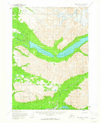
1954 Map of Lake Clark C-3
USGS Topo · Published 1964About this map
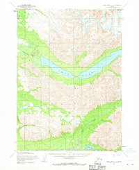
Twin Lakes dominates this mid-century Alaskan interior landscape, stretching through a prominent mountain valley. This area of the Lake and Peninsula region was mapped primarily through photogrammetric methods from 1957 aerial photography, with field annotations from the early 1950s. The drainage system is defined by the Chilikadrotna River flowing westward from the lakes and the Kijik River cutting through the southern mountains toward Portage Lake. A significant Native Trail is documented in the northwest corner, indicating established overland travel routes through the high passes long before formal roads reached this part of the territory. The map illustrates a transitional period where land lines were predetermined by the Bureau of Land Management but remained largely unsurveyed and unmarked on the ground.
Find a feature on this map
5 named features on this map. Tap any name to fly to it.
Don’t see what you’re looking for? This feature index may not catch every label — zoom into the map to look around manually.
Map Details
Editions of this 1954 Lake Clark C-3 Map
3 editions found
Other maps of this area

1946 · Lake Clark
USGS Topo · 1:250,000

1951 · Lake Clark
USGS Topo · 1:250,000

1954 · Lake Clark C-3
USGS Topo · 1:63,360

1954 · Lake Clark C-4
USGS Topo · 1:63,360

1954 · Lake Clark D-3
USGS Topo · 1:63,360

1954 · Lake Clark B-3
USGS Topo · 1:63,360

1954 · Lake Clark B-4
USGS Topo · 1:63,360

1954 · Lake Clark D-4
USGS Topo · 1:63,360
1958 · Lake Clark D-2
USGS Topo · 1:63,360

1958 · Lake Clark C-2
USGS Topo · 1:63,360