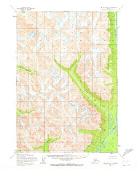
1954 Map of Lime Hills B-3
USGS Topo · Published 1972About this map
The Stony River winds through the eastern portion of this subarctic landscape, providing the primary drainage for a network of glacial meltwater streams. Fed by the high-altitude Tired Pup Glacier, the terrain is defined by the steep valleys of Tired Pup Creek and Little Underhill Creek. The map provides a look at a section of the Alaska interior that remained largely unvisited by permanent settlement in the mid-1950s, characterized instead by its complex hydrography and glacial movement. To the south, Kristin Creek flows through the lower elevations, illustrating the transition from ice-capped peaks to the braided river systems of the Bethel region. This survey, based on aerial photography from 1957 and field annotation from 1953-1954, documents the ice margins and watercourses before significant modern climatic shifts.
Find a feature on this map
7 named features on this map. Tap any name to fly to it.
Don’t see what you’re looking for? This feature index may not catch every label — zoom into the map to look around manually.
Map Details
Editions of this 1954 Lime Hills B-3 Map
2 editions found
Other maps of this area

1951 · Lime Hills
USGS Topo · 1:250,000

1954 · Lime Hills A-3
USGS Topo · 1:63,360

1954 · Lime Hills B-4
USGS Topo · 1:63,360

1954 · Lime Hills A-4
USGS Topo · 1:63,360

1954 · Lime Hills B-3
USGS Topo · 1:63,360

1958 · Lime Hills A-2
USGS Topo · 1:63,360

1958 · Lime Hills C-3
USGS Topo · 1:63,360

1958 · Lime Hills C-2
USGS Topo · 1:63,360

1958 · Lime Hills C-4
USGS Topo · 1:63,360
1958 · Lime Hills B-2
USGS Topo · 1:63,360