
1958 Map of Lime Hills D-3
USGS Topo · Published 1966About this map
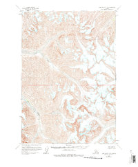
Big River carves through a landscape defined by extensive glacial activity and high-elevation ice fields in the late 1950s. This survey, conducted using photogrammetric methods from 1954 and 1957 aerial photography, reveals a terrain of sharp ridgelines and massive glaciers. The presence of numerous Crevasses across the ice sheets highlights the dynamic and shifting nature of the glaciers during this era. While the land lines represented here were predetermined by the Bureau of Land Management, they remained unsurveyed and unmarked on the ground at the time of publication, reflecting the true wilderness character of the region. The map captures a moment before significant modern changes, where the natural water systems and glacial movements were the primary features of the topography.
Find a feature on this map
2 named features on this map. Tap any name to fly to it.
Don’t see what you’re looking for? This feature index may not catch every label — zoom into the map to look around manually.
Map Details
Editions of this 1958 Lime Hills D-3 Map
2 editions found
Other maps of this area

1949 · McGrath
USGS Topo · 1:250,000

1950 · McGrath
USGS Topo · 1:250,000

1951 · Lime Hills
USGS Topo · 1:250,000

1958 · McGrath A-2
USGS Topo · 1:63,360

1958 · McGrath A-3
USGS Topo · 1:63,360

1958 · Lime Hills C-3
USGS Topo · 1:63,360

1958 · Lime Hills C-2
USGS Topo · 1:63,360

1958 · Lime Hills C-4
USGS Topo · 1:63,360
1958 · Lime Hills D-2
USGS Topo · 1:63,360
1958 · Lime Hills D-4
USGS Topo · 1:63,360