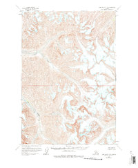
1958 Map of Lime Hills D-3
USGS Topo · Published 1976About this map
Big River and its tributary, the Lyman Fork, define the primary drainage systems through this high-altitude Alaskan landscape. Surveyed in the late 1950s using aerial photography, the map reveals a stark alpine environment where topographical relief is the dominant feature. Numerous crevasses are explicitly marked across the high ice fields and glaciers, signaling the active glacial movement and hazardous terrain characteristic of the region. The lack of any established roads, trails, or settlements at the time of the 1958 field annotation underscores the extreme isolation of this portion of the Lime Hills. This document serves as a specialized record of glacial geomorphology, capturing the positions of ice flows and drainage patterns before later twentieth-century climatic shifts.
Find a feature on this map
3 named features on this map. Tap any name to fly to it.
Don’t see what you’re looking for? This feature index may not catch every label — zoom into the map to look around manually.
Map Details
Editions of this 1958 Lime Hills D-3 Map
2 editions found
Other maps of this area

1949 · McGrath
USGS Topo · 1:250,000

1950 · McGrath
USGS Topo · 1:250,000

1951 · Lime Hills
USGS Topo · 1:250,000

1958 · McGrath A-2
USGS Topo · 1:63,360

1958 · McGrath A-3
USGS Topo · 1:63,360

1958 · Lime Hills C-3
USGS Topo · 1:63,360

1958 · Lime Hills C-2
USGS Topo · 1:63,360

1958 · Lime Hills D-3
USGS Topo · 1:63,360

1958 · Lime Hills C-4
USGS Topo · 1:63,360
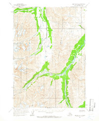
1958 · Lime Hills D-2
USGS Topo · 1:63,360