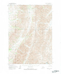
1954 Map of Bethel C-3
USGS Topo · Published 1983About this map
The Kuskokwim Mountains dominate this 1954 survey of the Alaskan interior, revealing a landscape defined by its drainages and mountain peaks. The Salmon River flows through the eastern portion of the quadrangle, while several significant tributaries like Swift Creek, Clear Creek, and Quartz Creek carve through the high terrain. This map captures the area before modern infrastructure arrived, noting that no roads or trails existed in the region at the time of the survey. A notable point of interest is the Quicksilver label in the southeast corner, indicating mineral potential or a named locality in this remote stretch of the Seward Meridian. The topographic data, based on 1957 aerial photography and 1954 field annotations, shows an unsurveyed wilderness where land lines were predetermined by the Bureau of Land Management rather than marked on the ground.
Find a feature on this map
6 named features on this map. Tap any name to fly to it.
Don’t see what you’re looking for? This feature index may not catch every label — zoom into the map to look around manually.
Map Details
Editions of this 1954 Bethel C-3 Map
3 editions found
Other maps of this area

1950 · Bethel
USGS Topo · 1:250,000

1954 · Bethel D-4
USGS Topo · 1:63,360

1954 · Bethel C-4
USGS Topo · 1:63,360

1954 · Bethel C-3
USGS Topo · 1:63,360

1954 · Bethel D-3
USGS Topo · 1:63,360

1954 · Bethel B-3
USGS Topo · 1:63,360

1954 · Bethel B-4
USGS Topo · 1:63,360

1979 · Bethel D-2
USGS Topo · 1:63,360

1979 · Bethel C-2
USGS Topo · 1:63,360

1979 · Bethel B-2
USGS Topo · 1:63,360