
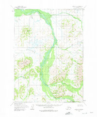
1954 Map of Bethel C-4
USGS Topo · Published 1965About this map
The Kisaralik River dominates this interior Alaskan landscape, winding through a complex network of wetlands and tundra before cutting between the Little Crow Hills and the prominent peaks of the Kilbuck Mountains. Photogrammetric surveys from the mid-1950s reveal a wild, roadless territory defined by its hydrology and relief. Significant landmarks like Spein Mountain and Nukluk Mountain provide the primary navigational references in a region where the Kasigluk River also carves its path across unsurveyed land lines. The presence of Golden Gate Falls on the Kisaralik suggests a rare point of dramatic topographical change along an otherwise braided and meandering river system. This map captures the area as it was managed by the Bureau of Land Management and the Army Map Service during a period of intense aerial mapping of the Alaskan bush.
Find a feature on this map
9 named features on this map. Tap any name to fly to it.
Don’t see what you’re looking for? This feature index may not catch every label — zoom into the map to look around manually.
Map Details
Editions of this 1954 Bethel C-4 Map
2 editions found
Other maps of this area

1950 · Bethel
USGS Topo · 1:250,000

1954 · Bethel D-4
USGS Topo · 1:63,360

1954 · Bethel C-5
USGS Topo · 1:63,360

1954 · Bethel C-3
USGS Topo · 1:63,360

1954 · Bethel D-5
USGS Topo · 1:63,360

1954 · Bethel D-3
USGS Topo · 1:63,360

1954 · Bethel B-3
USGS Topo · 1:63,360

1954 · Bethel B-4
USGS Topo · 1:63,360

1954 · Bethel B-5
USGS Topo · 1:63,360

1980 · Bethel
USGS Topo · 1:250,000