
1954 Map of Bethel D-4
USGS Topo · Published 1965About this map
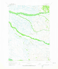
The Tuluksak River and its meandering tributaries dominate this mid-century topographic study of the Alaskan interior near Bethel. Based on aerial photography from 1955 and 1957, the map documents a transition between low-lying wetlands and the rising foothills to the east. Seasonal movement through this landscape is marked by a Winter Trail (Approximate) and a more established Winter Trail in the northern section, providing essential connections before the widespread adoption of modern infrastructure. This region, charted by the Army Map Service, highlights the complex hydrology of the Otter Creek and Fog River drainages, while the Kisaralik River cuts across the southwestern corner. The mapping of these unsurveyed lands provides a detailed look at the water-bound geography of the Seward Meridian during a period of active aerial surveying.
Find a feature on this map
6 named features on this map. Tap any name to fly to it.
Don’t see what you’re looking for? This feature index may not catch every label — zoom into the map to look around manually.
Map Details
Editions of this 1954 Bethel D-4 Map
3 editions found
Other maps of this area

1947 · Russian Mission
USGS Topo · 1:250,000

1950 · Russian Mission
USGS Topo · 1:250,000

1950 · Bethel
USGS Topo · 1:250,000

1954 · Russian Mission A-4
USGS Topo · 1:63,360

1954 · Russian Mission A-5
USGS Topo · 1:63,360

1954 · Bethel C-5
USGS Topo · 1:63,360

1954 · Bethel C-4
USGS Topo · 1:63,360

1954 · Bethel C-3
USGS Topo · 1:63,360

1954 · Bethel D-5
USGS Topo · 1:63,360

1954 · Russian Mission A-3
USGS Topo · 1:63,360