
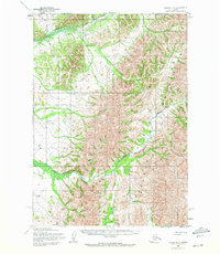
1954 Map of Bethel D-3
USGS Topo · Published 1965About this map
Nyac Airfield serves as a critical infrastructure point in this mid-century survey of the remote Alaska interior. The landscape is dominated by the Kilbuck Mountains, where high peaks like Fisher Dome rise above a dense network of waterways. Significant drainage systems, including the Tuluksak River and the Kilbuck River, carve through the terrain, joined by numerous tributaries such as Fog River and Slate Creek. The map detail reveals the isolated character of the region during the 1950s, with land use concentrated around the airfield and scattered watercourses like Mary Lou Gulch and Granite Creek. This USGS data captures the area prior to significant modern development, documenting the exact courses of Otter Creek and Karluk Creek as they weave through the high-elevation topography.
Find a feature on this map
11 named features on this map. Tap any name to fly to it.
Don’t see what you’re looking for? This feature index may not catch every label — zoom into the map to look around manually.
Map Details
Editions of this 1954 Bethel D-3 Map
2 editions found
Other maps of this area

1947 · Russian Mission
USGS Topo · 1:250,000

1950 · Russian Mission
USGS Topo · 1:250,000

1950 · Bethel
USGS Topo · 1:250,000

1954 · Russian Mission A-4
USGS Topo · 1:63,360

1954 · Bethel D-4
USGS Topo · 1:63,360

1954 · Bethel C-4
USGS Topo · 1:63,360

1954 · Bethel C-3
USGS Topo · 1:63,360

1954 · Russian Mission A-3
USGS Topo · 1:63,360

1979 · Bethel D-2
USGS Topo · 1:63,360

1979 · Russian Mission A-2
USGS Topo · 1:63,360