
1979 Map of Bethel C-2
USGS Topo · Published 1979About this map
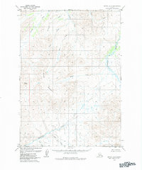
The Kipchuk River winds through the eastern portion of this subarctic landscape, part of an intricate drainage network defined by the Cripple Mountains and Mount Romig. Surveyed in the 1970s, the terrain is dominated by a complex system of waterways including the Salmon River and Porcupine Creek to the north, which give way to Quicksilver Creek and Anvil Creek in the south. The topographical detail reveals a land of high ridges and isolated peaks like the Dome, where the lack of roads or established trails underscores the wilderness character of the region during this era. This map serves as an essential record of the natural hydrology and elevation of the Bethel area before modern changes, documenting the exact courses of Bulldog Creek and Cripple Creek as they negotiate the high-relief interior.
Find a feature on this map
13 named features on this map. Tap any name to fly to it.
Don’t see what you’re looking for? This feature index may not catch every label — zoom into the map to look around manually.
Map Details
Editions of this 1979 Bethel C-2 Map
2 editions found
Other maps of this area

1950 · Bethel
USGS Topo · 1:250,000

1954 · Bethel C-3
USGS Topo · 1:63,360

1954 · Bethel D-3
USGS Topo · 1:63,360

1954 · Bethel B-3
USGS Topo · 1:63,360

1979 · Bethel D-2
USGS Topo · 1:63,360

1979 · Bethel B-1
USGS Topo · 1:63,360
1979 · Bethel D-1
USGS Topo · 1:63,360

1979 · Bethel B-2
USGS Topo · 1:63,360
1979 · Bethel C-1
USGS Topo · 1:63,360

1980 · Bethel
USGS Topo · 1:250,000