
1979 Map of Bethel B-1
USGS Topo · Published 1979About this map
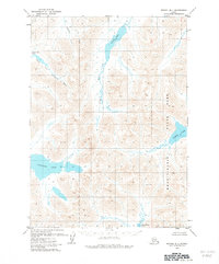
Wood-Tikchik State Park dominates the southeastern quadrant of this Alaskan landscape, where the headwaters of several major river systems converge among the interior mountains. The terrain is defined by substantial freshwater bodies including Kisaralik Lake and the elongated Upnuk Lake, which feed into a complex network of glacial-fed streams. The Aniak River flows north from Aniak Lake, while the western portion of the map is shaped by the North Fork Kisaralik River and its associated North Fork Lakes. This 1970s survey captures a wilderness devoid of roads or permanent settlements, where the natural drainage patterns of the Kipchuk River and other tributaries provide the only corridors for movement through the region. The map reflects the early years of the state park system and the enduring importance of these water networks for transit and subsistence in the Dillingham region.
Find a feature on this map
9 named features on this map. Tap any name to fly to it.
Don’t see what you’re looking for? This feature index may not catch every label — zoom into the map to look around manually.
Map Details
Editions of this 1979 Bethel B-1 Map
2 editions found
Other maps of this area

1950 · Bethel
USGS Topo · 1:250,000

1950 · Taylor Mountains
USGS Topo · 1:250,000

1951 · Taylor Mountains
USGS Topo · 1:250,000

1954 · Taylor Mountains
USGS Topo · 1:250,000

1954 · Taylor Mountains B-8
USGS Topo · 1:63,360

1954 · Taylor Mountains A-8
USGS Topo · 1:63,360

1954 · Taylor Mountains C-8
USGS Topo · 1:63,360

1979 · Bethel A-1
USGS Topo · 1:63,360

1979 · Bethel A-2
USGS Topo · 1:63,360

1979 · Bethel C-2
USGS Topo · 1:63,360