
1954 Map of Taylor Mountains C-8
USGS Topo · Published 1968About this map
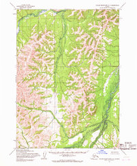
Gemuk Mountain and the Nishlik range dominate this interior Alaskan landscape, which was mapped from aerial photography in the mid-1950s. The drainage patterns of the Aniak River and its major tributaries, including the Gemuk River and Enatalik Creek, reveal a wilderness shaped by high-elevation runoff and glacial activity. A solitary Landing Strip north of the mountain peaks provides the only evidence of human infrastructure in this remote quadrant, likely serving as a critical point for local transport or geological surveying. The map traces the winding courses of lesser waterways like Bear Creek, Kashioli Creek, and Maka Creek, which offer a detailed look at the hydrology of the Taylor Mountains during this era of post-war exploration.
Find a feature on this map
9 named features on this map. Tap any name to fly to it.
Don’t see what you’re looking for? This feature index may not catch every label — zoom into the map to look around manually.
Map Details
Editions of this 1954 Taylor Mountains C-8 Map
This is the sole edition of this map. No revisions or reprints were ever made.
Other maps of this area

1950 · Bethel
USGS Topo · 1:250,000

1950 · Taylor Mountains
USGS Topo · 1:250,000

1951 · Taylor Mountains
USGS Topo · 1:250,000

1954 · Taylor Mountains
USGS Topo · 1:250,000

1954 · Taylor Mountains D-8
USGS Topo · 1:63,360

1954 · Taylor Mountains B-8
USGS Topo · 1:63,360

1954 · Taylor Mountains B-7
USGS Topo · 1:63,360
1954 · Taylor Mountains C-7
USGS Topo · 1:63,360
1954 · Taylor Mountains D-7
USGS Topo · 1:63,360

1979 · Bethel B-1
USGS Topo · 1:63,360