
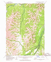
1954 Map of Taylor Mountains B-7
USGS Topo · Published 1968About this map
The King Salmon River and Tikchik River anchor this mid-century survey of the Taylor Mountains region, a remote Alaskan landscape defined by its intricate drainage systems. Mapping efforts conducted by the Army Map Service and the Geological Survey in the early 1950s captured the shifting courses of these vital waterways before modern satellite imaging became the standard. The Kogrukluk River flows through the northern reaches of the quadrangle, while Maka Creek winds through the high-altitude terrain, illustrating the glacial and fluvial processes that have shaped this subarctic environment. The presence of unsurveyed and unmarked land lines, as noted by the Bureau of Land Management, highlights the era's ongoing effort to formalize territory in the Alaskan interior during a period of expanding scientific study.
Find a feature on this map
4 named features on this map. Tap any name to fly to it.
Don’t see what you’re looking for? This feature index may not catch every label — zoom into the map to look around manually.
Map Details
Editions of this 1954 Taylor Mountains B-7 Map
This is the sole edition of this map. No revisions or reprints were ever made.
Other maps of this area

1950 · Taylor Mountains
USGS Topo · 1:250,000

1951 · Taylor Mountains
USGS Topo · 1:250,000

1954 · Taylor Mountains
USGS Topo · 1:250,000

1954 · Taylor Mountains B-8
USGS Topo · 1:63,360

1954 · Taylor Mountains A-8
USGS Topo · 1:63,360
1954 · Taylor Mountains C-7
USGS Topo · 1:63,360

1954 · Taylor Mountains B-6
USGS Topo · 1:63,360

1954 · Taylor Mountains C-6
USGS Topo · 1:63,360

1954 · Taylor Mountains A-6
USGS Topo · 1:63,360

1954 · Taylor Mountains C-8
USGS Topo · 1:63,360