
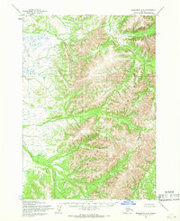
1954 Map of Taylor Mountains D-8
USGS Topo · Published 1968About this map
Flat Top Mountain dominates this interior landscape, standing as a central topographical anchor in a region defined by its complex drainage systems. Surveyed in the mid-1950s, the map reveals the sparse infrastructure of the Seward Meridian, where travel and residency were dictated by the water. Along Cinnabar Creek, the presence of Cabins and a Landing Strip points to localized activity, likely tied to the mineral namesake of the creek or seasonal subsistence. The drainage network is extensive, with Atsaksovluk Creek and Waterboot Creek carving through the terrain before reaching the broader Gemuk River and Beaver Creek systems. These features illustrate a classic Alaskan interior wilderness before modern development, where isolated outposts and aircraft access were the primary means of navigating the territory.
Find a feature on this map
10 named features on this map. Tap any name to fly to it.
Don’t see what you’re looking for? This feature index may not catch every label — zoom into the map to look around manually.
Map Details
Editions of this 1954 Taylor Mountains D-8 Map
This is the sole edition of this map. No revisions or reprints were ever made.
Other maps of this area

1947 · Russian Mission
USGS Topo · 1:250,000

1950 · Russian Mission
USGS Topo · 1:250,000

1950 · Sleetmute
USGS Topo · 1:250,000

1950 · Bethel
USGS Topo · 1:250,000

1950 · Taylor Mountains
USGS Topo · 1:250,000

1951 · Taylor Mountains
USGS Topo · 1:250,000

1954 · Sleetmute
USGS Topo · 1:250,000

1954 · Taylor Mountains
USGS Topo · 1:250,000

1954 · Sleetmute A-7
USGS Topo · 1:63,360
1954 · Sleetmute A-8
USGS Topo · 1:63,360