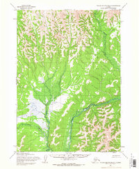
1954 Map of Taylor Mountains D-7
USGS Topo · Published 1968About this map
The Cauldron River winds through this unpopulated portion of southwest Alaska, reflecting the landscape as it was documented by the Army Map Service in the mid-1950s. This survey, based on aerial photography from 1953 and 1955, shows a wilderness primarily defined by its drainage basins rather than human infrastructure. The Gemuk River and Oksobelik Creek serve as the primary landmarks in a region devoid of roads or trails at the time of mapping. Indigenous place names such as Chikukulnuk and Enatalik Creek identify the vital waterways that have historically provided access and sustenance to the area. Topographic features like Talik and Chuk highlight the elevation shifts in the Taylor Mountains, while the map's notation of unsurveyed and unmarked land lines underscores the immense scale and isolation of this interior territory during the mid-century period.
Find a feature on this map
8 named features on this map. Tap any name to fly to it.
Don’t see what you’re looking for? This feature index may not catch every label — zoom into the map to look around manually.
Map Details
Editions of this 1954 Taylor Mountains D-7 Map
This is the sole edition of this map. No revisions or reprints were ever made.
Other maps of this area

1950 · Sleetmute
USGS Topo · 1:250,000

1950 · Taylor Mountains
USGS Topo · 1:250,000

1951 · Taylor Mountains
USGS Topo · 1:250,000

1954 · Sleetmute
USGS Topo · 1:250,000

1954 · Taylor Mountains
USGS Topo · 1:250,000

1954 · Taylor Mountains D-8
USGS Topo · 1:63,360

1954 · Sleetmute A-7
USGS Topo · 1:63,360

1954 · Taylor Mountains D-6
USGS Topo · 1:63,360
1954 · Sleetmute A-8
USGS Topo · 1:63,360
1954 · Taylor Mountains C-7
USGS Topo · 1:63,360