
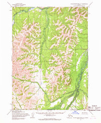
1954 Map of Taylor Mountains D-6
USGS Topo · Published 1968About this map
The Chukowan River winds through this unpopulated wilderness in the Kuskokwim Mountains, documented here through photogrammetric methods from 1953 aerial photography. The terrain is defined by a dense network of drainages and prominent rises, most notably Kazik Hill, which stands as a central landmark amidst the elevation contours. Land lines shown here represent unsurveyed and unmarked locations as predetermined by the Bureau of Land Management for the Seward Meridian. Tributaries like Muktulik Creek and Oksoktarik Creek carve through the landscape, illustrating the natural hydrological patterns of this interior region before any modern infrastructure or roads were established. This 1954 field annotation captures the area in a purely wild state, where the river systems served as the primary features for orientation.
Find a feature on this map
6 named features on this map. Tap any name to fly to it.
Don’t see what you’re looking for? This feature index may not catch every label — zoom into the map to look around manually.
Map Details
Editions of this 1954 Taylor Mountains D-6 Map
This is the sole edition of this map. No revisions or reprints were ever made.
Other maps of this area

1950 · Sleetmute
USGS Topo · 1:250,000

1950 · Taylor Mountains
USGS Topo · 1:250,000

1951 · Taylor Mountains
USGS Topo · 1:250,000

1954 · Sleetmute
USGS Topo · 1:250,000

1954 · Taylor Mountains
USGS Topo · 1:250,000

1954 · Sleetmute A-5
USGS Topo · 1:63,360

1954 · Sleetmute A-7
USGS Topo · 1:63,360

1954 · Taylor Mountains D-5
USGS Topo · 1:63,360
1954 · Taylor Mountains C-7
USGS Topo · 1:63,360

1954 · Sleetmute A-6
USGS Topo · 1:63,360