
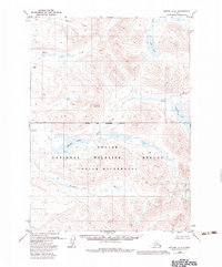
1979 Map of Bethel A-2
USGS Topo · Published 1979About this map
The Kwethluk River winds through this unpopulated Alaskan interior, defining a landscape of complex hydrological patterns and upland peaks. Surveyed via aerial photography in the early 1970s, the terrain is dominated by the prominent elevation of Crooked Mountain and the expansive waters of Heart Lake. The mapping reveals a transition from the lower elevations near the river to the higher ridges and tributary networks in the north, where the drainage of Akoswift Creek and Little Swift Creek originates. This topographic study documents a wilderness devoid of roads or permanent settlements, emphasizing instead the natural landmarks and water systems like Gold Lake and the Milk Creek drainage that would serve as the primary navigational aids for local travel and resource management in this region of the Bethel quadrangle.
Find a feature on this map
11 named features on this map. Tap any name to fly to it.
Don’t see what you’re looking for? This feature index may not catch every label — zoom into the map to look around manually.
Map Details
Editions of this 1979 Bethel A-2 Map
2 editions found
Other maps of this area

1950 · Bethel
USGS Topo · 1:250,000

1951 · Goodnews
USGS Topo · 1:250,000

1954 · Bethel B-3
USGS Topo · 1:63,360

1979 · Bethel B-1
USGS Topo · 1:63,360

1979 · Bethel A-3
USGS Topo · 1:63,360

1979 · Goodnews Bay D-3
USGS Topo · 1:63,360

1979 · Bethel A-1
USGS Topo · 1:63,360

1979 · Goodnews Bay D-1
USGS Topo · 1:63,360

1979 · Goodnews Bay
USGS Topo · 1:250,000

1979 · Bethel B-2
USGS Topo · 1:63,360