
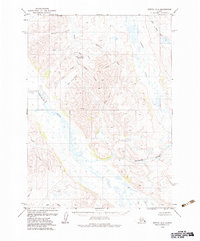
1979 Map of Bethel A-3
USGS Topo · Published 1979About this map
The Kwethluk River winds through this sub-arctic landscape, providing a central drainage for the numerous waterways that define the region. In the late 1970s, the area remained largely undeveloped, with human presence marked by the remote Canyon Creek Landing Strip located near the base of Polar Mountain. The terrain is a complex network of wetlands and high ground, where Canyon Creek and its tributary Bear Creek cut through the topography.
Find a feature on this map
18 named features on this map. Tap any name to fly to it.
Don’t see what you’re looking for? This feature index may not catch every label — zoom into the map to look around manually.
Map Details
Editions of this 1979 Bethel A-3 Map
2 editions found
Other maps of this area

1950 · Bethel
USGS Topo · 1:250,000

1951 · Goodnews
USGS Topo · 1:250,000

1954 · Bethel A-4
USGS Topo · 1:63,360

1954 · Bethel B-3
USGS Topo · 1:63,360

1954 · Bethel B-4
USGS Topo · 1:63,360

1954 · Goodnews D-4
USGS Topo · 1:63,360

1979 · Goodnews Bay D-3
USGS Topo · 1:63,360

1979 · Bethel A-2
USGS Topo · 1:63,360

1979 · Goodnews Bay
USGS Topo · 1:250,000

1979 · Bethel B-2
USGS Topo · 1:63,360