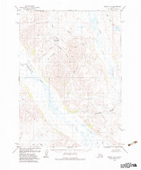
1979 Map of Bethel A-3
USGS Topo · Published 1983About this map
The Kwethuluk River and its intricate network of tributaries define this Alaskan landscape in the late 1970s. This survey records a wilderness shaped by water, where the Eek River cuts across the southern reach and various drainages like Willow Creek and Crooked Creek move through the high ground. A notable point of human activity is the Canyon Creek Landing Strip, located near the confluence of Canyon Creek and Bear Creek. The map provides a detailed view of the terrain before more modern developments, preserving the original nomenclature of local features such as Rich Gulch, Polar Creek, and Little Swift Creek. For those tracing the geography of the Bethel region, the sheet illustrates the transition from the upland basins of Slate Creek to the expansive wetlands and braided channels that dominate the lower elevations.
Find a feature on this map
19 named features on this map. Tap any name to fly to it.
Don’t see what you’re looking for? This feature index may not catch every label — zoom into the map to look around manually.
Map Details
Editions of this 1979 Bethel A-3 Map
2 editions found
Other maps of this area

1950 · Bethel
USGS Topo · 1:250,000

1951 · Goodnews
USGS Topo · 1:250,000

1954 · Bethel A-4
USGS Topo · 1:63,360

1954 · Bethel B-3
USGS Topo · 1:63,360

1954 · Bethel B-4
USGS Topo · 1:63,360

1954 · Goodnews D-4
USGS Topo · 1:63,360

1979 · Bethel A-3
USGS Topo · 1:63,360

1979 · Goodnews Bay D-3
USGS Topo · 1:63,360

1979 · Bethel A-2
USGS Topo · 1:63,360

1979 · Goodnews Bay
USGS Topo · 1:250,000