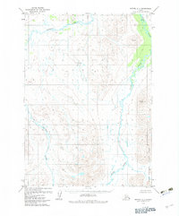
1979 Map of Bethel C-1
USGS Topo · Published 1979About this map
Aniak River meanders through this remote Alaskan landscape, carving a prominent path through the southwestern interior just as it was surveyed in the late 1970s. The map captures the meeting of the Kipchuk River and the Aniak, a confluence that historically defined navigation and travel for local subsistence and early exploration. The eastern edge of the quadrangle includes the rugged boundaries of Wood-Tikchik State Park, reflecting a period of formal land conservation in the Dillingham region. Rising above the river valleys, Gemuk Mtn stands as the primary landmark in a territory otherwise characterized by complex water networks and tundra. This sheet preserves the topography of a wilderness area where human footprints were primarily limited to river corridors and traditional land use before more modern infrastructure reached the deeper interior.
Find a feature on this map
4 named features on this map. Tap any name to fly to it.
Don’t see what you’re looking for? This feature index may not catch every label — zoom into the map to look around manually.
Map Details
Editions of this 1979 Bethel C-1 Map
2 editions found
Other maps of this area

1950 · Bethel
USGS Topo · 1:250,000

1950 · Taylor Mountains
USGS Topo · 1:250,000

1951 · Taylor Mountains
USGS Topo · 1:250,000

1954 · Taylor Mountains
USGS Topo · 1:250,000

1954 · Taylor Mountains D-8
USGS Topo · 1:63,360

1954 · Taylor Mountains B-8
USGS Topo · 1:63,360

1954 · Taylor Mountains C-8
USGS Topo · 1:63,360

1979 · Bethel D-2
USGS Topo · 1:63,360

1979 · Bethel B-1
USGS Topo · 1:63,360
1979 · Bethel D-1
USGS Topo · 1:63,360