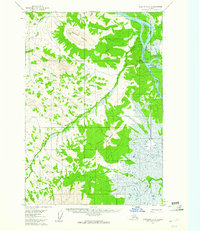
1954 Map of Sleetmute C-4
USGS Topo · Published 1961About this map
The Kuskokwim River serves as the primary artery for travel and trade in this mid-century look at interior Alaska, where the settlement of Sleetmute sits at the confluence with the Holitna River. This specific era captures a small but vital hub of river-based commerce, centered around Mellicks Trading Post and a nearby airstrip. The map illustrates the dependence on natural waterways and land trails, with a Tractor Trail and a simple Trail providing the only terrestrial connections through the dense vegetation.
Find a feature on this map
21 named features on this map. Tap any name to fly to it.
Don’t see what you’re looking for? This feature index may not catch every label — zoom into the map to look around manually.
Map Details
Editions of this 1954 Sleetmute C-4 Map
2 editions found
Other maps of this area

1950 · Sleetmute
USGS Topo · 1:250,000

1954 · Sleetmute C-4
USGS Topo · 1:63,360

1954 · Sleetmute D-5
USGS Topo · 1:63,360

1954 · Sleetmute D-4
USGS Topo · 1:63,360

1954 · Sleetmute D-3
USGS Topo · 1:63,360

1954 · Sleetmute C-3
USGS Topo · 1:63,360

1954 · Sleetmute C-5
USGS Topo · 1:63,360

1954 · Sleetmute
USGS Topo · 1:250,000

1954 · Sleetmute B-3
USGS Topo · 1:63,360

1954 · Sleetmute B-5
USGS Topo · 1:63,360