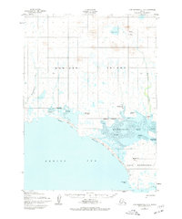
1952 Map of Cape Mendenhall D-4
USGS Topo · Published 1977About this map
Nunivak Island coastal life is centered around seasonal camps and water-access points on this mid-century survey. The southern shoreline of the island is defined by a series of Indigenous summer camps, such as Iwarawiramiut and Chikungamiut, situated along the sheltered waters of Duchikthluk Bay. This settlement pattern reflects a traditional reliance on the sea's resources during the warmer months, with camps strategically placed near the mouths of the Binajoaksmiut River and Duchikmiut River.
Find a feature on this map
22 named features on this map. Tap any name to fly to it.
Don’t see what you’re looking for? This feature index may not catch every label — zoom into the map to look around manually.
Map Details
Editions of this 1952 Cape Mendenhall D-4 Map
2 editions found
Other maps of this area

1951 · Cape Mendenhall
USGS Topo · 1:250,000

1951 · Nunivak Island
USGS Topo · 1:250,000

1952 · Cape Mendenhall D-4
USGS Topo · 1:63,360

1952 · Cape Mendenhall D-3
USGS Topo · 1:63,360

1952 · Nunivak Island A-4
USGS Topo · 1:63,360

1952 · Cape Mendenhall
USGS Topo · 1:250,000

1952 · Nunivak Island A-5
USGS Topo · 1:63,360

1952 · Nunivak Island A-3
USGS Topo · 1:63,360
1952 · Cape Mendenhall D-5
USGS Topo · 1:63,360

1954 · Nunivak Island
USGS Topo · 1:250,000