
1952 Map of Nunivak Island A-5
USGS Topo · Published 1958About this map
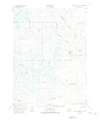
Nunivak Island is documented here through a 1952 topographic lens, revealing a landscape defined by volcanic landforms and glacial drainages within the Nunivak National Wildlife Refuge. The map identifies prominent heights such as Indooli Mountain and Ahding Ingria Mountain, which rise above a complex network of waterways including the Ahding River and the Narksmiut River. Along the northern shoreline, Nash Harbor is protected by Ahkolikotak Head, showing the coastal features like Dachikjowaruk Cove.
Find a feature on this map
17 named features on this map. Tap any name to fly to it.
Don’t see what you’re looking for? This feature index may not catch every label — zoom into the map to look around manually.
Map Details
Editions of this 1952 Nunivak Island A-5 Map
2 editions found
Other maps of this area

1951 · Cape Mendenhall
USGS Topo · 1:250,000

1951 · Nunivak Island
USGS Topo · 1:250,000

1952 · Cape Mendenhall D-4
USGS Topo · 1:63,360

1952 · Nunivak Island A-4
USGS Topo · 1:63,360

1952 · Cape Mendenhall
USGS Topo · 1:250,000

1952 · Cape Mendenhall D-6
USGS Topo · 1:63,360

1952 · Nunivak Island A-6
USGS Topo · 1:63,360
1952 · Nunivak Island B-5
USGS Topo · 1:63,360
1952 · Cape Mendenhall D-5
USGS Topo · 1:63,360
1952 · Nunivak Island B-4
USGS Topo · 1:63,360