
1952 Map of Cape Mendenhall
USGS Topo · Published 1958About this map
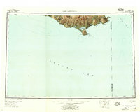
Nunivak Island dominates this mid-century survey of Alaska's southwestern coastline, where the land meets the Bering Sea. The map documents a sparsely settled landscape defined by shifting sands and glacial topography, featuring extensive coastal formations such as the Bangookthleet Dunes and Nunathloogamiutbungo Dunes. Along the southeastern shore, the Nakooytoolekmiut (Site) marks a point of human history near Cape Mendenhall. Several water bodies, including the Duchikthluk River and Dahloongamiut Lagoon, drain the island's interior hills like Ingrijoak Hill and Jayalik Hill. This survey provides a record of the Nunivak National Wildlife Refuge as it stood in the early 1950s, also noting the boundary between the Second Judicial Division and the Fourth Judicial Division running through the Etolin Strait.
Find a feature on this map
24 named features on this map. Tap any name to fly to it.
Don’t see what you’re looking for? This feature index may not catch every label — zoom into the map to look around manually.
Map Details
Editions of this 1952 Cape Mendenhall Map
5 editions found
Other maps of this area

1951 · Kuskokwim Bay
USGS Topo · 1:250,000

1951 · Cape Mendenhall
USGS Topo · 1:250,000

1951 · Nunivak Island
USGS Topo · 1:250,000

1951 · Baird Inlet
USGS Topo · 1:250,000

1952 · Cape Mendenhall D-4
USGS Topo · 1:63,360

1952 · Cape Mendenhall D-3
USGS Topo · 1:63,360

1952 · Nunivak Island A-4
USGS Topo · 1:63,360

1952 · Nunivak Island A-7
USGS Topo · 1:63,360

1952 · Cape Mendenhall D-6
USGS Topo · 1:63,360

1952 · Nunivak Island A-6
USGS Topo · 1:63,360