
1952 Map of Cape Mendenhall D-3
USGS Topo · Published 1958About this map
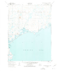
Bimiut and other seasonal indigenous settlements line the southern coastline of Nunivak Island in the early 1950s. This survey, compiled from aerial photography, captures a landscape of subsistence and survival within the Nunivak National Wildlife Refuge. The coast is defined by shifting sands and treacherous shorelines, ranging from the Oongalambingoi Dunes to areas of Mud and Boulders. Several traditional seasonal camps are documented, including Nunathloogagamiut and Etikamiut, situated near critical resources. The interior is dominated by topographical markers like Ingriruk Hill, while the southern extremity terminates at the prominent Cape Mendenhall and Irwakyaruk Pt, where the land meets the Bering Sea. The map provides a precise record of these seasonal locations before modern shifts in settlement patterns, offering a clear view of the island's geography as it was understood at mid-century.
Find a feature on this map
19 named features on this map. Tap any name to fly to it.
Don’t see what you’re looking for? This feature index may not catch every label — zoom into the map to look around manually.
Map Details
Editions of this 1952 Cape Mendenhall D-3 Map
2 editions found
Other maps of this area

1951 · Cape Mendenhall
USGS Topo · 1:250,000

1951 · Nunivak Island
USGS Topo · 1:250,000

1952 · Cape Mendenhall D-4
USGS Topo · 1:63,360

1952 · Nunivak Island A-4
USGS Topo · 1:63,360

1952 · Cape Mendenhall
USGS Topo · 1:250,000
1952 · Cape Mendenhall D-2
USGS Topo · 1:63,360

1952 · Nunivak Island A-3
USGS Topo · 1:63,360
1952 · Nunivak Island A-2
USGS Topo · 1:63,360

1954 · Nunivak Island
USGS Topo · 1:250,000

1958 · Nunivak Island
USGS Topo · 1:250,000