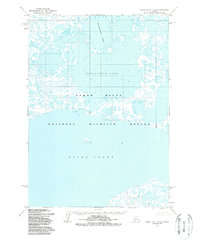
1954 Map of Baird Inlet D-6
USGS Topo · Published 1989About this map
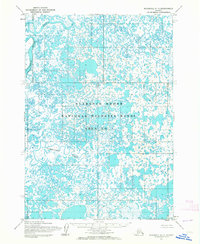
Kagalurpak Lake and Goldeneye Lake dominate this 1954 topographic record of the Alaskan wetlands. The landscape is a labyrinth of unnamed ponds and marshy lowlands within the Yukon Delta National Wildlife Refuge, illustrating the complex hydrology of the region before any modern human development. The northern reaches of Baird Inlet are visible at the bottom of the sheet, where the land fragmentates into a dense network of smaller water bodies. This 1950s survey reflects the preservation of the area as a vast natural sanctuary, with no roads, trails, or permanent structures indicated across the entire quadrangle, emphasizing its isolation and importance as a habitat for migratory birds and native wildlife.
Find a feature on this map
4 named features on this map. Tap any name to fly to it.
Don’t see what you’re looking for? This feature index may not catch every label — zoom into the map to look around manually.
Map Details
Editions of this 1954 Baird Inlet D-6 Map
2 editions found
Other maps of this area

1951 · Marshall
USGS Topo · 1:250,000

1951 · Baird Inlet
USGS Topo · 1:250,000
1953 · Marshall A-5
USGS Topo · 1:63,360
1953 · Baird Inlet C-5
USGS Topo · 1:63,360

1953 · Baird Inlet D-5
USGS Topo · 1:63,360
1953 · Baird Inlet C-6
USGS Topo · 1:63,360

1954 · Baird Inlet D-6
USGS Topo · 1:63,360

1954 · Marshall A-6
USGS Topo · 1:63,360
1954 · Marshall A-7
USGS Topo · 1:63,360

1954 · Baird Inlet C-7
USGS Topo · 1:63,360