
1954 Map of Marshall A-6
USGS Topo · Published 1964About this map
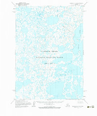
Clarence Rhode National Wildlife Range Area No 1 dominates this landscape in the Yukon-Kuskokwim Delta, as recorded during a mid-century photogrammetric survey. The terrain is characterized by an intricate, almost hypnotic network of thousands of small tundra ponds and larger water bodies, most notably Aropuk Lake in the northeast. This 1954 field-annotated study reveals the complex hydrology of the region, where land and water are so intermixed that much of the map is defined by an Indefinite Boundary. The absence of roads, trails, or permanent human settlements underscores the preserved nature of this subarctic wilderness prior to its 1960 designation as part of the broader national wildlife refuge system.
Find a feature on this map
3 named features on this map. Tap any name to fly to it.
Don’t see what you’re looking for? This feature index may not catch every label — zoom into the map to look around manually.
Map Details
Editions of this 1954 Marshall A-6 Map
2 editions found
Other maps of this area

1951 · Marshall
USGS Topo · 1:250,000

1951 · Baird Inlet
USGS Topo · 1:250,000
1953 · Marshall A-5
USGS Topo · 1:63,360

1953 · Marshall B-6
USGS Topo · 1:63,360

1953 · Marshall B-7
USGS Topo · 1:63,360

1953 · Marshall B-5
USGS Topo · 1:63,360

1953 · Baird Inlet D-5
USGS Topo · 1:63,360

1954 · Baird Inlet D-6
USGS Topo · 1:63,360
1954 · Marshall A-7
USGS Topo · 1:63,360

1954 · Baird Inlet D-7
USGS Topo · 1:63,360