
1954 Map of Baird Inlet D-7
USGS Topo · Published 1965About this map
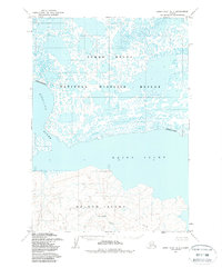
Nelson Island anchors the southern portion of this region, its topography rising in sharp contrast to the water-saturated lowlands to the north. At the base of these hills lies the settlement of Chakchak, positioned near a small Creek that drains toward the coast. The landscape is dominated by the complex aquatic network of the Clarence Rhode National Wildlife Area No 1, a sprawling mosaic of small lakes and ponds that illustrate the saturated nature of the Yukon-Kuskokwim Delta.
Find a feature on this map
11 named features on this map. Tap any name to fly to it.
Don’t see what you’re looking for? This feature index may not catch every label — zoom into the map to look around manually.
Map Details
Editions of this 1954 Baird Inlet D-7 Map
2 editions found
Other maps of this area

1951 · Marshall
USGS Topo · 1:250,000

1951 · Baird Inlet
USGS Topo · 1:250,000
1953 · Baird Inlet C-6
USGS Topo · 1:63,360

1954 · Baird Inlet D-6
USGS Topo · 1:63,360
1954 · Marshall A-8
USGS Topo · 1:63,360

1954 · Marshall A-6
USGS Topo · 1:63,360
1954 · Marshall A-7
USGS Topo · 1:63,360

1954 · Baird Inlet C-7
USGS Topo · 1:63,360

1954 · Marshall
USGS Topo · 1:250,000

1954 · Baird Inlet
USGS Topo · 1:250,000