
1953 Map of Marshall B-5
USGS Topo · Published 1964About this map
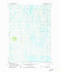
Ingakslugwat Hills rise as a singular cluster of volcanic landforms above the water-logged lowlands of the Yukon-Kuskokwim Delta. This 1953 field-annotated survey, published by the U.S. Geological Survey, reveals a landscape dominated by a intricate maze of unnamed lakes, ponds, and sloughs typical of this subarctic tundra environment. The most prominent hydrological feature is Kgun Lake, situated in the northern portion of the quadrangle. The map reflects a period before modern infrastructure, noting that land lines represent unsurveyed and unmarked locations predetermined by the Bureau of Land Management. The lack of roads or trails highlights the isolation of this terrain, where movement was dictated entirely by the season and the complex network of waterways.
Find a feature on this map
2 named features on this map. Tap any name to fly to it.
Don’t see what you’re looking for? This feature index may not catch every label — zoom into the map to look around manually.
Map Details
Editions of this 1953 Marshall B-5 Map
2 editions found
Other maps of this area

1951 · Marshall
USGS Topo · 1:250,000

1952 · Marshall C-6
USGS Topo · 1:63,360

1952 · Marshall C-5
USGS Topo · 1:63,360
1953 · Marshall A-5
USGS Topo · 1:63,360

1953 · Marshall B-6
USGS Topo · 1:63,360

1954 · Marshall B-4
USGS Topo · 1:63,360

1954 · Marshall A-6
USGS Topo · 1:63,360

1954 · Marshall C-4
USGS Topo · 1:63,360
1954 · Marshall A-4
USGS Topo · 1:63,360

1954 · Marshall
USGS Topo · 1:250,000