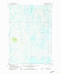
1953 Map of Marshall B-5
USGS Topo · Published 1972About this map
Kgun Lake sits as the dominant water body in this northern region of the Yukon-Kuskokwim Delta, part of a landscape defined by an intricate network of wetlands and tundra ponds. This 1953 field-annotated survey, based on aerial photography from 1951, reveals the complex hydrological character of the area before modern developments. While the terrain is largely low-lying and dominated by water, Tik Hill provides a singular point of elevation in the southwestern portion of the map, rising above the surrounding marshlands. These features illustrate the natural topography that shaped subsistence and movement patterns for local communities in the mid-twentieth century. The mapping, produced by the Army Map Service and the Bureau of Land Management, captures an era of primary surveying when land lines remained largely unsurveyed and unmarked on the ground.
Find a feature on this map
2 named features on this map. Tap any name to fly to it.
Don’t see what you’re looking for? This feature index may not catch every label — zoom into the map to look around manually.
Map Details
Editions of this 1953 Marshall B-5 Map
2 editions found
Other maps of this area

1951 · Marshall
USGS Topo · 1:250,000

1952 · Marshall C-6
USGS Topo · 1:63,360

1952 · Marshall C-5
USGS Topo · 1:63,360
1953 · Marshall A-5
USGS Topo · 1:63,360

1953 · Marshall B-6
USGS Topo · 1:63,360

1953 · Marshall B-5
USGS Topo · 1:63,360

1954 · Marshall B-4
USGS Topo · 1:63,360

1954 · Marshall A-6
USGS Topo · 1:63,360

1954 · Marshall C-4
USGS Topo · 1:63,360
1954 · Marshall A-4
USGS Topo · 1:63,360