
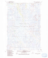
1954 Map of Marshall C-4
USGS Topo · Published 1964About this map
The Kashunuk River meanders across a landscape defined by an intricate network of countless ponds, lakes, and wetlands in this remote section of Alaska. Based on 1951 aerial photography and 1954 field annotation, the map depicts a saturated coastal plain where water dominates the geography, leaving narrow corridors of green vegetation along the river's winding path. The intricate drainage patterns and thousands of unnamed water bodies illustrated here provide a detailed record of the terrain as it appeared before mid-century. This survey, compiled by the Army Map Service and published by the Geological Survey, captures the hydrological complexity of the region during a period when land lines represented unsurveyed and unmarked locations predetermined by the Bureau of Land Management.
Find a feature on this map
1 named feature on this map. Tap any name to fly to it.
Don’t see what you’re looking for? This feature index may not catch every label — zoom into the map to look around manually.
Map Details
Editions of this 1954 Marshall C-4 Map
2 editions found
Other maps of this area

1951 · Marshall
USGS Topo · 1:250,000

1952 · Marshall D-5
USGS Topo · 1:63,360

1952 · Marshall D-4
USGS Topo · 1:63,360

1952 · Marshall C-5
USGS Topo · 1:63,360

1952 · Marshall D-3
USGS Topo · 1:63,360

1953 · Marshall B-5
USGS Topo · 1:63,360

1954 · Marshall B-4
USGS Topo · 1:63,360

1954 · Marshall C-3
USGS Topo · 1:63,360

1954 · Marshall B-3
USGS Topo · 1:63,360

1954 · Marshall
USGS Topo · 1:250,000