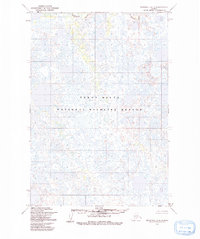
1954 Map of Marshall C-4
USGS Topo · Published 1982About this map
Kashunuk River meanders across this mid-century topographic survey, defining the fluid landscape of the Yukon Delta National Wildlife Refuge. The map depicts an intricate network of wetlands, sloughs, and countless small water bodies characteristic of the coastal tundra in western Alaska. Compiled from aerial photography taken in 1951, the data reflects the natural drainage patterns of the delta before significant environmental changes or modern infrastructure reached this remote region. The absence of roads or settlements on this sheet emphasizes the wilderness character of the refuge, where the shifting channels of the Kashunuk River serve as the primary geographical markers for this portion of the Kusilvak region.
Find a feature on this map
2 named features on this map. Tap any name to fly to it.
Don’t see what you’re looking for? This feature index may not catch every label — zoom into the map to look around manually.
Map Details
Editions of this 1954 Marshall C-4 Map
2 editions found
Other maps of this area

1951 · Marshall
USGS Topo · 1:250,000

1952 · Marshall D-5
USGS Topo · 1:63,360

1952 · Marshall D-4
USGS Topo · 1:63,360

1952 · Marshall C-5
USGS Topo · 1:63,360

1952 · Marshall D-3
USGS Topo · 1:63,360

1953 · Marshall B-5
USGS Topo · 1:63,360

1954 · Marshall B-4
USGS Topo · 1:63,360

1954 · Marshall C-3
USGS Topo · 1:63,360

1954 · Marshall B-3
USGS Topo · 1:63,360

1954 · Marshall C-4
USGS Topo · 1:63,360