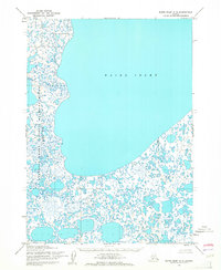
1953 Map of Baird Inlet C-5
USGS Topo · Published 1964About this map
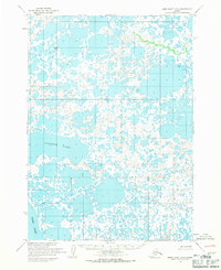
Baird Inlet dominates this 1953 survey, illustrating the complex transition from open water to the marshy coastal lowlands of western Alaska. The shoreline is defined by a dense network of countless small ponds, sloughs, and thaw lakes, characteristic of the Yukon-Kuskokwim Delta region. This map covers a portion of the Clarence Rhode National Wildlife Range Area No 2, a designation established to manage this critical habitat. At the time of this mapping by the Army Map Service, the area remained almost entirely wild, with no roads or permanent structures recorded, reflecting the seasonal and subsistence patterns of the landscape prior to later conservation and administrative changes.
Find a feature on this map
2 named features on this map. Tap any name to fly to it.
Don’t see what you’re looking for? This feature index may not catch every label — zoom into the map to look around manually.
Map Details
Editions of this 1953 Baird Inlet C-5 Map
2 editions found
Other maps of this area

1951 · Baird Inlet
USGS Topo · 1:250,000

1953 · Baird Inlet D-5
USGS Topo · 1:63,360
1953 · Baird Inlet C-6
USGS Topo · 1:63,360

1953 · Baird Inlet B-5
USGS Topo · 1:63,360

1954 · Baird Inlet D-6
USGS Topo · 1:63,360

1954 · Baird Inlet
USGS Topo · 1:250,000
1954 · Baird Inlet C-4
USGS Topo · 1:63,360

1954 · Baird Inlet B-6
USGS Topo · 1:63,360
1954 · Baird Inlet D-4
USGS Topo · 1:63,360
1954 · Baird Inlet B-4
USGS Topo · 1:63,360