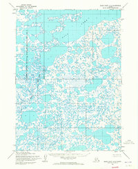
1953 Map of Baird Inlet B-5
USGS Topo · Published 1965About this map
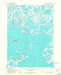
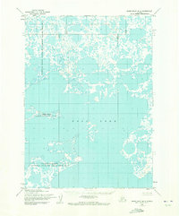
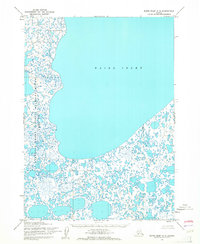
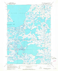
Dall Lake dominates the central portion of this 1950s survey, representing a vast and intricate aquatic landscape within the Yukon-Kuskokwim Delta. The map depicts a complex mosaic of water and land, characterized by thousands of small, unnamed tundra ponds and larger interconnected water bodies that define the Clarence Rhode National Wildlife Range Area No 2. Based on aerial photography from 1952, the topography captures the region before its later administrative changes and name updates. The intricate shoreline of Dall Lake, with its many points and coves, highlights a wilderness environment where no roads or trails existed at the time of the field annotation. This map provides a technical foundation for understanding the hydrological patterns of this specific Alaskan quadrangle during the mid-twentieth century.
Find a feature on this map
2 named features on this map. Tap any name to fly to it.
Don’t see what you’re looking for? This feature index may not catch every label — zoom into the map to look around manually.
Map Details
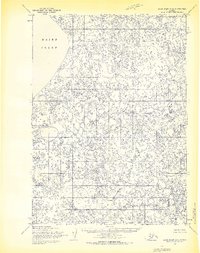
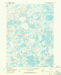
Editions of this 1953 Baird Inlet B-5 Map
3 editions found

Other maps of this area

1951 · Baird Inlet
USGS Topo · 1:250,000
1953 · Baird Inlet C-5
USGS Topo · 1:63,360
1953 · Baird Inlet C-6
USGS Topo · 1:63,360
1954 · Baird Inlet A-5
USGS Topo · 1:63,360

1954 · Baird Inlet
USGS Topo · 1:250,000
1954 · Baird Inlet C-4
USGS Topo · 1:63,360

1954 · Baird Inlet B-6
USGS Topo · 1:63,360

1954 · Baird Inlet B-4
USGS Topo · 1:63,360

1954 · Baird Inlet A-6
USGS Topo · 1:63,360
1954 · Baird Inlet A-4
USGS Topo · 1:63,360