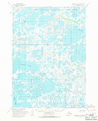
1954 Map of Baird Inlet D-4
USGS Topo · Published 1971About this map
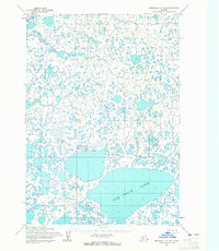
Kagaluk Lake dominates this complex wetland environment within the Yukon-Kuskokwim Delta, as mapped by the U.S. Army Topographic Command from mid-century aerial photography. The landscape is a intricate network of ponds and small water bodies characteristic of the Alaskan tundra. Near the northern edge of the sheet, the label Chifftak (Site) indicates a specific historical location or camp within this water-logged terrain. To the southwest, the waters of Baird Inlet enter the frame, showing the transition toward larger coastal bodies. The lack of established roads or trails underscores the remote nature of this region during the 1950s, where movement was primarily defined by these waterways and seasonal conditions.
Find a feature on this map
6 named features on this map. Tap any name to fly to it.
Don’t see what you’re looking for? This feature index may not catch every label — zoom into the map to look around manually.
Map Details
Editions of this 1954 Baird Inlet D-4 Map
2 editions found
Other maps of this area

1951 · Marshall
USGS Topo · 1:250,000

1951 · Baird Inlet
USGS Topo · 1:250,000
1953 · Marshall A-5
USGS Topo · 1:63,360
1953 · Baird Inlet C-5
USGS Topo · 1:63,360

1953 · Baird Inlet D-5
USGS Topo · 1:63,360

1954 · Marshall A-3
USGS Topo · 1:63,360
1954 · Marshall A-4
USGS Topo · 1:63,360

1954 · Marshall
USGS Topo · 1:250,000

1954 · Baird Inlet
USGS Topo · 1:250,000
1954 · Baird Inlet C-4
USGS Topo · 1:63,360