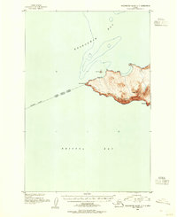
1952 Map of Hagemeister Island C-7
USGS Topo · Published 1955About this map
Cape Newenham forms a dramatic topographical boundary on this 1952 chart, where the waters of Kuskokwim Bay meet the northern expanse of Bristol Bay. This coastal survey, compiled by the U.S. Coast and Geodetic Survey using aerial photography from the late 1940s, focuses on the isolated mountainous terrain of the peninsula. High points like Jagged Mtn and Oracle Mtn dominate the shoreline, while the small outlier Bird Rock sits just off the northern coast. An approximate boundary line runs through the water, marking the official separation between the Fourth Judicial Division and the Third Judicial Division. The map provides detailed bathymetric depth curves and precise elevation contours for this uninhabited stretch of the Alaskan coast.
Find a feature on this map
7 named features on this map. Tap any name to fly to it.
Don’t see what you’re looking for? This feature index may not catch every label — zoom into the map to look around manually.
Map Details
Editions of this 1952 Hagemeister Island C-7 Map
This is the sole edition of this map. No revisions or reprints were ever made.
Other maps of this area
1947 · Hagemeister Island C-7
USGS Topo · 1:63,360

1948 · Hagemeister Island C-6
USGS Topo · 1:63,360

1950 · Hagemeister Island D-6
USGS Topo · 1:63,360

1951 · Hagemeister Island
USGS Topo · 1:250,000

1952 · Hagemeister Island C-6
USGS Topo · 1:63,360

1957 · Hagemeister Island
USGS Topo · 1:250,000
2018 · Hagemeister Island C-6 NW
USGS Topo · 1:25,000
2018 · Hagemeister Island D-6 SW
USGS Topo · 1:25,000
2018 · Hagemeister Island C-6 SW
USGS Topo · 1:25,000
2018 · Hagemeister Island C-7 SE
USGS Topo · 1:25,000