
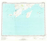
1957 Map of Hagemeister Island
USGS Topo · Published 1966About this map
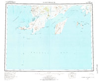
Goodnews Mining Camp and the nearby Dredge Tailings along the Salmon River define the industrial footprint of this coastal Alaska region during the mid-twentieth century. The landscape is characterized by a complex network of bays and straits, with the massive Hagemeister Island separated from the mainland by the Hagemeister Strait. To the west, the rugged coastline around Cape Newenham and Cape Peirce shelters Security Cove and Chagvan Bay, while the small settlement of Kinegnak sits at the mouth of its namesake river. Farther east, the Walrus Islands and Summit Island dot the entrance to Togiak Bay. This survey captures the region's transition into a more established mining and maritime territory, documenting the precise locations of remote landing areas and mountain peaks such as Oracle Mtn and Slug Mtn that guided early aviators and mariners.
Find a feature on this map
75 named features on this map. Tap any name to fly to it.
Don’t see what you’re looking for? This feature index may not catch every label — zoom into the map to look around manually.
Map Details
Editions of this 1957 Hagemeister Island Map
3 editions found
Other maps of this area

1945 · Nushagak Bay
USGS Topo · 1:250,000
1947 · Hagemeister Island C-7
USGS Topo · 1:63,360

1947 · Hagemeister Island D-2
USGS Topo · 1:63,360

1948 · Hagemeister Island D-3
USGS Topo · 1:63,360

1948 · Hagemeister Island C-6
USGS Topo · 1:63,360

1948 · Hagemeister Island C-4
USGS Topo · 1:63,360

1948 · Hagemeister Island C-3
USGS Topo · 1:63,360
1948 · Hagemeister Island C-2
USGS Topo · 1:63,360

1948 · Hagemeister Island C-1
USGS Topo · 1:63,360

1948 · Hagemeister Island C-5
USGS Topo · 1:63,360