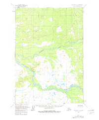
1954 Map of Lime Hills C-7
USGS Topo · Published 1981About this map
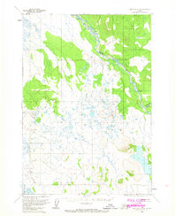
Swift River and the Gagaryah River dominate this wilderness landscape in the Kuskokwim River drainage, captured during a 1954 field annotation. This survey depicts the intricate braids and oxbows of the river systems as they wind through a complex topography of low-lying wetlands and elevated ridge lines. The map's detail focuses heavily on the natural hydrology of the region, indicating numerous unnamed lakes and swampy depressions that define the wet lowland areas. Mapped by the Geological Survey using aerial photography from 1953, the area is notably devoid of human settlements, roads, or trails at the time of the survey, reflecting the remote nature of this portion of Alaska. The contours and water features provide a precise record of the physical geography before any modern infrastructure changes, making it a valuable reference for understanding the original state of the Swift River valley and its surrounding tributaries.
Find a feature on this map
2 named features on this map. Tap any name to fly to it.
Don’t see what you’re looking for? This feature index may not catch every label — zoom into the map to look around manually.
Map Details
Editions of this 1954 Lime Hills C-7 Map
2 editions found
Other maps of this area

1951 · Lime Hills
USGS Topo · 1:250,000
1954 · Lime Hills D-7
USGS Topo · 1:63,360
1954 · Lime Hills C-7
USGS Topo · 1:63,360

1954 · Lime Hills D-6
USGS Topo · 1:63,360

1954 · Lime Hills C-6
USGS Topo · 1:63,360
1954 · Lime Hills D-8
USGS Topo · 1:63,360

1954 · Lime Hills B-7
USGS Topo · 1:63,360

1954 · Lime Hills B-8
USGS Topo · 1:63,360

1954 · Lime Hills B-6
USGS Topo · 1:63,360
1958 · Lime Hills C-8
USGS Topo · 1:63,360