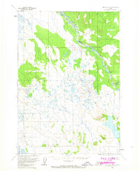
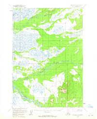
1958 Map of Lime Hills C-8
USGS Topo · Published 1965About this map
Swift River and the Gagaryah River dominate this interior Alaskan landscape, which was mapped via photogrammetric methods from aerial photography taken in 1953. The terrain is characterized by complex braided river systems and an extensive network of unnamed ponds and marshes across the Seward Meridian. This 1958 edition, later published by the Geological Survey in 1965, documents a period before significant infrastructure reached this remote region. The map displays land lines that represent unsurveyed and unmarked locations predetermined by the Bureau of Land Management, reflecting the early administrative efforts to organize this wilderness. Without roads, trails, or settlements indicated, the map serves as a primary record of the natural hydrology and topography of the Lime Hills quadrangle as it stood in the mid-20th century.
Find a feature on this map
2 named features on this map. Tap any name to fly to it.
Don’t see what you’re looking for? This feature index may not catch every label — zoom into the map to look around manually.
Map Details
Editions of this 1958 Lime Hills C-8 Map
2 editions found
Other maps of this area

1950 · Sleetmute
USGS Topo · 1:250,000

1951 · Lime Hills
USGS Topo · 1:250,000

1954 · Sleetmute D-1
USGS Topo · 1:63,360

1954 · Sleetmute C-1
USGS Topo · 1:63,360
1954 · Lime Hills D-7
USGS Topo · 1:63,360
1954 · Lime Hills C-7
USGS Topo · 1:63,360
1954 · Lime Hills D-8
USGS Topo · 1:63,360

1954 · Sleetmute
USGS Topo · 1:250,000

1954 · Lime Hills B-7
USGS Topo · 1:63,360

1954 · Lime Hills B-8
USGS Topo · 1:63,360