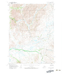
1954 Map of Bethel B-3
USGS Topo · Published 1983About this map
The Buck Mountains dominate this mid-century Alaskan interior, where the glacial drainage systems of the Kuskokwim Delta region are captured in fine topographic detail. The terrain is defined by the winding course of the Kisaralik River, which drops through Upper Falls and Lower Falls as it navigates the western slopes. Multiple distinct watersheds converge here, including the systems of Crooked Creek and Fork Creek in the south, and the northern drainage of Swift Creek.
Find a feature on this map
11 named features on this map. Tap any name to fly to it.
Don’t see what you’re looking for? This feature index may not catch every label — zoom into the map to look around manually.
Map Details
Editions of this 1954 Bethel B-3 Map
3 editions found
Other maps of this area

1950 · Bethel
USGS Topo · 1:250,000

1954 · Bethel C-4
USGS Topo · 1:63,360

1954 · Bethel C-3
USGS Topo · 1:63,360

1954 · Bethel A-4
USGS Topo · 1:63,360

1954 · Bethel B-3
USGS Topo · 1:63,360

1954 · Bethel B-4
USGS Topo · 1:63,360

1979 · Bethel A-3
USGS Topo · 1:63,360

1979 · Bethel A-2
USGS Topo · 1:63,360

1979 · Bethel C-2
USGS Topo · 1:63,360

1979 · Bethel B-2
USGS Topo · 1:63,360