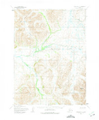
1954 Map of Goodnews D-4
USGS Topo · Published 1975About this map
The Eek Mountains dominate the northwestern portion of this mid-century Alaskan survey, where high summits like Eek Mountain rise above a complex network of glacial valleys and river systems. The Kanektok River meanders across the central landscape, fed by numerous tributaries including Tsayagtulek Creek and Kanuktuk Creek. In the southeast, Nuklunek Mountain stands as a prominent landmark. This topographic study, compiled from aerial photography taken in the 1950s, documents a vast wilderness area without road classification, where travel was dictated by the flow of the Eek River and the orientation of the high ridges. The map reflects the Bureau of Land Management's work in establishing unsurveyed land lines across the Bethel region during a period of systematic aerial mapping by the Army Map Service.
Find a feature on this map
9 named features on this map. Tap any name to fly to it.
Don’t see what you’re looking for? This feature index may not catch every label — zoom into the map to look around manually.
Map Details
Editions of this 1954 Goodnews D-4 Map
2 editions found
Other maps of this area

1950 · Bethel
USGS Topo · 1:250,000

1951 · Goodnews
USGS Topo · 1:250,000

1954 · Bethel A-5
USGS Topo · 1:63,360

1954 · Bethel A-4
USGS Topo · 1:63,360

1954 · Goodnews C-4
USGS Topo · 1:63,360

1954 · Goodnews D-4
USGS Topo · 1:63,360

1954 · Goodnews D-5
USGS Topo · 1:63,360

1979 · Goodnews Bay C-5
USGS Topo · 1:63,360

1979 · Bethel A-3
USGS Topo · 1:63,360

1979 · Goodnews Bay D-3
USGS Topo · 1:63,360