1954 Map of Goodnews D-5
USGS Topo · Published 1968About this map
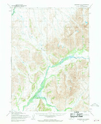
The Kanektok River carves a dominant path through this southwestern Alaskan landscape, where the Eek Mountains define the northern and eastern horizons. Photogrammetric methods using aerial photography from 1957 captured this region at a time when its terrain remained largely unsurveyed on the ground, as noted by the Bureau of Land Management. The hydrological network is the primary feature of this quadrangle, with the Eek River and several significant tributaries, including Klak Creek, Nakailingak Creek, and Sam Creek, branching out through the valleys. The absence of roads or permanent structures in this 1954 field-annotated survey highlights the area's isolation and its reliance on natural waterways for navigation and orientation.
Find a feature on this map
6 named features on this map. Tap any name to fly to it.
Don’t see what you’re looking for? This feature index may not catch every label — zoom into the map to look around manually.
Map Details
Editions of this 1954 Goodnews D-5 Map
2 editions found
Historical Maps of Unorganized Borough Through Time
1082 maps found

1947 Hagemeister Island C-7
Bethel Borough, AK

1947 Russian Mission
Bethel Borough, AK

1948 Hagemeister Island C-5
Bethel Borough, AK

1948 Hagemeister Island C-6
Bethel Borough, AK

1950 Hagemeister Island D-5
Bethel Borough, AK

1950 Hagemeister Island D-6
Bethel Borough, AK

1950 Russian Mission
Bethel Borough, AK

1951 Baird Inlet
Bethel Borough, AK

1951 Cape Mendenhall
Bethel Borough, AK

1951 Kuskokwim Bay
Bethel Borough, AK

1951 Lime Hills
Bethel Borough, AK

1951 Nunivak Island
Bethel Borough, AK

1951 St Matthew
Bethel Borough, AK

1952 Cape Mendenhall
Bethel Borough, AK

1952 Cape Mendenhall D-2
Bethel Borough, AK

1952 Cape Mendenhall D-3
Bethel Borough, AK

1952 Cape Mendenhall D-4
Bethel Borough, AK

1952 Cape Mendenhall D-5
Bethel Borough, AK

1952 Cape Mendenhall D-6
Bethel Borough, AK

1952 Hagemeister Island C-5
Bethel Borough, AK

1952 Hagemeister Island C-6
Bethel Borough, AK

1952 Hagemeister Island C-7
Bethel Borough, AK

1952 Nunivak Island A-2
Bethel Borough, AK

1952 Nunivak Island A-3
Bethel Borough, AK

1952 Nunivak Island A-4
Bethel Borough, AK

1952 Nunivak Island A-5
Bethel Borough, AK

1952 Nunivak Island A-6
Bethel Borough, AK

1952 Nunivak Island A-7
Bethel Borough, AK

1952 Nunivak Island B-2
Bethel Borough, AK

1952 Nunivak Island B-3
Bethel Borough, AK

1952 Nunivak Island B-4
Bethel Borough, AK

1952 Nunivak Island B-5
Bethel Borough, AK

1952 Russian Mission B-1
Bethel Borough, AK

1952 Russian Mission B-2
Bethel Borough, AK

1952 Russian Mission B-3
Bethel Borough, AK

1952 Russian Mission B-6
Bethel Borough, AK

1952 Russian Mission B-7
Bethel Borough, AK

1952 Russian Mission B-8
Bethel Borough, AK

1952 Russian Mission C-1
Bethel Borough, AK

1952 Russian Mission C-2
Bethel Borough, AK

1952 Russian Mission C-3
Bethel Borough, AK

1952 Russian Mission C-5
Bethel Borough, AK

1952 Russian Mission C-6
Bethel Borough, AK

1952 Russian Mission D-1
Bethel Borough, AK

1952 Russian Mission D-2
Bethel Borough, AK

1952 Russian Mission D-3
Bethel Borough, AK

1952 Russian Mission D-4
Bethel Borough, AK

1953 Baird Inlet B-5
Bethel Borough, AK

1953 Baird Inlet C-5
Bethel Borough, AK

1953 Baird Inlet C-6
Bethel Borough, AK

1953 Baird Inlet D-5
Bethel Borough, AK

1953 Kuskokwim Bay D-2
Bethel Borough, AK

1953 Marshall A-5
Bethel Borough, AK

1954 Baird Inlet A-1
Bethel Borough, AK

1954 Baird Inlet A-2
Bethel Borough, AK

1954 Baird Inlet A-3
Bethel Borough, AK

1954 Baird Inlet A-4
Bethel Borough, AK

1954 Baird Inlet A-5
Bethel Borough, AK

1954 Baird Inlet A-6
Bethel Borough, AK

1954 Baird Inlet A-7
Bethel Borough, AK

1954 Baird Inlet B-1
Bethel Borough, AK

1954 Baird Inlet B-2
Bethel Borough, AK

1954 Baird Inlet B-3
Bethel Borough, AK

1954 Baird Inlet B-4
Bethel Borough, AK

1954 Baird Inlet B-6
Bethel Borough, AK

1954 Baird Inlet B-7
Bethel Borough, AK

1954 Baird Inlet B-8
Bethel Borough, AK

1954 Baird Inlet
Bethel Borough, AK

1954 Baird Inlet C-1
Bethel Borough, AK

1954 Baird Inlet C-2
Bethel Borough, AK

1954 Baird Inlet C-3
Bethel Borough, AK

1954 Baird Inlet C-4
Bethel Borough, AK

1954 Baird Inlet C-7
Bethel Borough, AK

1954 Baird Inlet C-8
Bethel Borough, AK

1954 Baird Inlet D-1
Bethel Borough, AK

1954 Baird Inlet D-2
Bethel Borough, AK

1954 Baird Inlet D-3
Bethel Borough, AK

1954 Baird Inlet D-4
Bethel Borough, AK

1954 Baird Inlet D-6
Bethel Borough, AK

1954 Baird Inlet D-7
Bethel Borough, AK

1954 Baird Inlet D-8
Bethel Borough, AK

1954 Bethel A-4
Bethel Borough, AK

1954 Bethel A-5
Bethel Borough, AK

1954 Bethel A-6
Bethel Borough, AK

1954 Bethel A-7
Bethel Borough, AK

1954 Bethel A-8
Bethel Borough, AK

1954 Bethel B-3
Bethel Borough, AK

1954 Bethel B-4
Bethel Borough, AK

1954 Bethel B-5
Bethel Borough, AK

1954 Bethel B-6
Bethel Borough, AK

1954 Bethel B-7
Bethel Borough, AK

1954 Bethel B-8
Bethel Borough, AK

1954 Bethel C-3
Bethel Borough, AK

1954 Bethel C-4
Bethel Borough, AK

1954 Bethel C-5
Bethel Borough, AK

1954 Bethel C-6
Bethel Borough, AK

1954 Bethel C-7
Bethel Borough, AK

1954 Bethel C-8
Bethel Borough, AK

1954 Bethel D-3
Bethel Borough, AK

1954 Bethel D-4
Bethel Borough, AK

1954 Bethel D-5
Bethel Borough, AK

1954 Bethel D-6
Bethel Borough, AK

1954 Bethel D-7
Bethel Borough, AK

1954 Bethel D-8
Bethel Borough, AK

1954 Goodnews A-6
Bethel Borough, AK

1954 Goodnews B-6
Bethel Borough, AK

1954 Goodnews B-8
Bethel Borough, AK

1954 Goodnews Bay A-7
Bethel Borough, AK

1954 Goodnews Bay A-8
Bethel Borough, AK

1954 Goodnews Bay B-7
Bethel Borough, AK

1954 Goodnews Bay D-8
Bethel Borough, AK

1954 Goodnews C-6
Bethel Borough, AK

1954 Goodnews C-7
Bethel Borough, AK

1954 Goodnews C-8
Bethel Borough, AK

1954 Goodnews D-4
Bethel Borough, AK

1954 Goodnews D-5
Bethel Borough, AK

1954 Goodnews D-6
Bethel Borough, AK

1954 Goodnews D-7
Bethel Borough, AK

1954 Hagemeister Island D-4
Bethel Borough, AK

1954 Hagemeister Island D-5
Bethel Borough, AK

1954 Kuskokwim Bay
Bethel Borough, AK

1954 Kuskokwim Bay D-1
Bethel Borough, AK

1954 Kuskokwim Bay D-3
Bethel Borough, AK

1954 Kuskokwim Bay D-4
Bethel Borough, AK

1954 Kuskokwim Bay D-5
Bethel Borough, AK

1954 Kuskokwim Bay D-6
Bethel Borough, AK

1954 Kuskokwim Bay D-7
Bethel Borough, AK

1954 Lime Hills A-3
Bethel Borough, AK

1954 Lime Hills A-4
Bethel Borough, AK

1954 Lime Hills A-5
Bethel Borough, AK

1954 Lime Hills A-6
Bethel Borough, AK

1954 Lime Hills A-7
Bethel Borough, AK

1954 Lime Hills A-8
Bethel Borough, AK

1954 Lime Hills B-3
Bethel Borough, AK

1954 Lime Hills B-4
Bethel Borough, AK

1954 Lime Hills B-5
Bethel Borough, AK

1954 Lime Hills B-6
Bethel Borough, AK

1954 Lime Hills B-7
Bethel Borough, AK

1954 Lime Hills B-8
Bethel Borough, AK

1954 Lime Hills C-5
Bethel Borough, AK

1954 Lime Hills C-6
Bethel Borough, AK

1954 Lime Hills C-7
Bethel Borough, AK

1954 Lime Hills D-5
Bethel Borough, AK

1954 Lime Hills D-6
Bethel Borough, AK

1954 Lime Hills D-7
Bethel Borough, AK

1954 Lime Hills D-8
Bethel Borough, AK

1954 Marshall A-1
Bethel Borough, AK

1954 Marshall A-2
Bethel Borough, AK

1954 Marshall A-3
Bethel Borough, AK

1954 Marshall A-4
Bethel Borough, AK

1954 Marshall A-6
Bethel Borough, AK

1954 Marshall B-1
Bethel Borough, AK

1954 Marshall B-2
Bethel Borough, AK

1954 Marshall B-3
Bethel Borough, AK

1954 Marshall B-4
Bethel Borough, AK

1954 Nunivak Island B-1
Bethel Borough, AK

1954 Nunivak Island
Bethel Borough, AK

1954 Nunivak Island C-1
Bethel Borough, AK

1954 Nunivak Island D-1
Bethel Borough, AK

1954 Russian Mission A-3
Bethel Borough, AK

1954 Russian Mission A-4
Bethel Borough, AK

1954 Russian Mission A-5
Bethel Borough, AK

1954 Russian Mission A-6
Bethel Borough, AK

1954 Russian Mission A-7
Bethel Borough, AK

1954 Russian Mission A-8
Bethel Borough, AK

1954 Russian Mission B-4
Bethel Borough, AK

1954 Russian Mission B-5
Bethel Borough, AK

1954 Russian Mission C-4
Bethel Borough, AK

1954 Sleetmute A-1
Bethel Borough, AK

1954 Sleetmute A-2
Bethel Borough, AK

1954 Sleetmute A-3
Bethel Borough, AK

1954 Sleetmute A-4
Bethel Borough, AK

1954 Sleetmute A-5
Bethel Borough, AK

1954 Sleetmute A-6
Bethel Borough, AK

1954 Sleetmute A-7
Bethel Borough, AK

1954 Sleetmute A-8
Bethel Borough, AK

1954 Sleetmute B-1
Bethel Borough, AK

1954 Sleetmute B-2
Bethel Borough, AK

1954 Sleetmute B-3
Bethel Borough, AK

1954 Sleetmute B-4
Bethel Borough, AK

1954 Sleetmute B-5
Bethel Borough, AK

1954 Sleetmute B-6
Bethel Borough, AK

1954 Sleetmute B-7
Bethel Borough, AK

1954 Sleetmute B-8
Bethel Borough, AK

1954 Sleetmute C-1
Bethel Borough, AK

1954 Sleetmute C-2
Bethel Borough, AK

1954 Sleetmute C-3
Bethel Borough, AK

1954 Sleetmute C-4
Bethel Borough, AK

1954 Sleetmute C-5
Bethel Borough, AK

1954 Sleetmute C-6
Bethel Borough, AK

1954 Sleetmute C-8
Bethel Borough, AK

1954 Sleetmute D-1
Bethel Borough, AK

1954 Sleetmute D-2
Bethel Borough, AK

1954 Sleetmute D-3
Bethel Borough, AK

1954 Sleetmute D-4
Bethel Borough, AK

1954 Sleetmute D-5
Bethel Borough, AK

1954 Sleetmute D-6
Bethel Borough, AK

1954 Sleetmute D-7
Bethel Borough, AK

1954 Sleetmute D-8
Bethel Borough, AK

1957 Sleetmute C-7
Bethel Borough, AK

1958 Lime Hills A-2
Bethel Borough, AK

1958 Lime Hills B-2
Bethel Borough, AK

1958 Lime Hills
Bethel Borough, AK

1958 Lime Hills C-1
Bethel Borough, AK

1958 Lime Hills C-2
Bethel Borough, AK

1958 Lime Hills C-3
Bethel Borough, AK

1958 Lime Hills C-4
Bethel Borough, AK

1958 Lime Hills C-8
Bethel Borough, AK

1958 Lime Hills D-1
Bethel Borough, AK

1958 Lime Hills D-2
Bethel Borough, AK

1958 Lime Hills D-3
Bethel Borough, AK

1958 Lime Hills D-4
Bethel Borough, AK

1958 McGrath A-1
Bethel Borough, AK

1958 Nunivak Island
Bethel Borough, AK

1964 Bethel A-6
Bethel Borough, AK

1964 Nunivak Island
Bethel Borough, AK

1969 St. Matthew
Bethel Borough, AK

1979 Bethel A-3
Bethel Borough, AK

1979 Bethel B-2
Bethel Borough, AK

1979 Bethel C-2
Bethel Borough, AK

1979 Bethel D-1
Bethel Borough, AK

1979 Bethel D-2
Bethel Borough, AK

1979 Goodnews Bay B-5
Bethel Borough, AK

1979 Goodnews Bay C-5
Bethel Borough, AK

1979 Russian Mission A-1
Bethel Borough, AK

1979 Russian Mission A-2
Bethel Borough, AK

1980 Russian Mission
Bethel Borough, AK

2017 Baird Inlet A-1 NE
Bethel Borough, AK

2017 Baird Inlet A-1 NW
Bethel Borough, AK

2017 Baird Inlet A-1 SE
Bethel Borough, AK

2017 Baird Inlet A-1 SW
Bethel Borough, AK

2017 Baird Inlet A-2 NE
Bethel Borough, AK

2017 Baird Inlet A-2 NW
Bethel Borough, AK

2017 Baird Inlet A-2 SE
Bethel Borough, AK

2017 Baird Inlet A-2 SW
Bethel Borough, AK

2017 Baird Inlet A-3 NE
Bethel Borough, AK

2017 Baird Inlet A-3 SE
Bethel Borough, AK

2017 Baird Inlet B-1 NE
Bethel Borough, AK

2017 Baird Inlet B-1 NW
Bethel Borough, AK

2017 Baird Inlet B-1 SE
Bethel Borough, AK

2017 Baird Inlet B-1 SW
Bethel Borough, AK

2017 Baird Inlet B-2 NE
Bethel Borough, AK

2017 Baird Inlet B-2 NW
Bethel Borough, AK

2017 Baird Inlet B-2 SE
Bethel Borough, AK

2017 Baird Inlet B-2 SW
Bethel Borough, AK

2017 Baird Inlet B-3 NE
Bethel Borough, AK

2017 Baird Inlet B-3 SE
Bethel Borough, AK

2017 Baird Inlet C-1 NE
Bethel Borough, AK

2017 Baird Inlet C-1 NW
Bethel Borough, AK

2017 Baird Inlet C-1 SE
Bethel Borough, AK

2017 Baird Inlet C-1 SW
Bethel Borough, AK

2017 Baird Inlet C-2 NE
Bethel Borough, AK

2017 Baird Inlet C-2 NW
Bethel Borough, AK

2017 Baird Inlet C-2 SE
Bethel Borough, AK

2017 Baird Inlet C-2 SW
Bethel Borough, AK

2017 Baird Inlet C-3 NE
Bethel Borough, AK

2017 Baird Inlet C-3 SE
Bethel Borough, AK

2017 Baird Inlet D-1 NE
Bethel Borough, AK

2017 Baird Inlet D-1 NW
Bethel Borough, AK

2017 Baird Inlet D-1 SE
Bethel Borough, AK

2017 Baird Inlet D-1 SW
Bethel Borough, AK

2017 Baird Inlet D-2 NE
Bethel Borough, AK

2017 Baird Inlet D-2 NW
Bethel Borough, AK

2017 Baird Inlet D-2 SE
Bethel Borough, AK

2017 Baird Inlet D-2 SW
Bethel Borough, AK

2017 Baird Inlet D-3 NE
Bethel Borough, AK

2017 Baird Inlet D-3 SE
Bethel Borough, AK

2017 Bethel A-4 NE
Bethel Borough, AK

2017 Bethel A-4 NW
Bethel Borough, AK

2017 Bethel A-4 SE
Bethel Borough, AK

2017 Bethel A-4 SW
Bethel Borough, AK

2017 Bethel A-5 NE
Bethel Borough, AK

2017 Bethel A-5 NW
Bethel Borough, AK

2017 Bethel A-5 SE
Bethel Borough, AK

2017 Bethel A-5 SW
Bethel Borough, AK

2017 Bethel A-6 NE
Bethel Borough, AK

2017 Bethel A-6 NW
Bethel Borough, AK

2017 Bethel A-6 SE
Bethel Borough, AK

2017 Bethel A-6 SW
Bethel Borough, AK

2017 Bethel A-7 NE
Bethel Borough, AK

2017 Bethel A-7 NW
Bethel Borough, AK

2017 Bethel A-7 SE
Bethel Borough, AK

2017 Bethel A-7 SW
Bethel Borough, AK

2017 Bethel A-8 NE
Bethel Borough, AK

2017 Bethel A-8 NW
Bethel Borough, AK

2017 Bethel A-8 SE
Bethel Borough, AK

2017 Bethel A-8 SW
Bethel Borough, AK

2017 Bethel B-4 NE
Bethel Borough, AK

2017 Bethel B-4 NW
Bethel Borough, AK

2017 Bethel B-4 SE
Bethel Borough, AK

2017 Bethel B-4 SW
Bethel Borough, AK

2017 Bethel B-5 NE
Bethel Borough, AK

2017 Bethel B-5 NW
Bethel Borough, AK

2017 Bethel B-5 SE
Bethel Borough, AK

2017 Bethel B-5 SW
Bethel Borough, AK

2017 Bethel B-6 NE
Bethel Borough, AK

2017 Bethel B-6 NW
Bethel Borough, AK

2017 Bethel B-6 SE
Bethel Borough, AK

2017 Bethel B-6 SW
Bethel Borough, AK

2017 Bethel B-7 NE
Bethel Borough, AK

2017 Bethel B-7 NW
Bethel Borough, AK

2017 Bethel B-7 SE
Bethel Borough, AK

2017 Bethel B-7 SW
Bethel Borough, AK

2017 Bethel B-8 NE
Bethel Borough, AK

2017 Bethel B-8 NW
Bethel Borough, AK

2017 Bethel B-8 SE
Bethel Borough, AK

2017 Bethel B-8 SW
Bethel Borough, AK

2017 Bethel C-4 NE
Bethel Borough, AK

2017 Bethel C-4 NW
Bethel Borough, AK

2017 Bethel C-4 SE
Bethel Borough, AK

2017 Bethel C-4 SW
Bethel Borough, AK

2017 Bethel C-5 NE
Bethel Borough, AK

2017 Bethel C-5 NW
Bethel Borough, AK

2017 Bethel C-5 SE
Bethel Borough, AK

2017 Bethel C-5 SW
Bethel Borough, AK

2017 Bethel C-6 NE
Bethel Borough, AK

2017 Bethel C-6 NW
Bethel Borough, AK

2017 Bethel C-6 SE
Bethel Borough, AK

2017 Bethel C-6 SW
Bethel Borough, AK

2017 Bethel C-7 NE
Bethel Borough, AK

2017 Bethel C-7 NW
Bethel Borough, AK

2017 Bethel C-7 SE
Bethel Borough, AK

2017 Bethel C-7 SW
Bethel Borough, AK

2017 Bethel C-8 NE
Bethel Borough, AK

2017 Bethel C-8 NW
Bethel Borough, AK

2017 Bethel C-8 SE
Bethel Borough, AK

2017 Bethel C-8 SW
Bethel Borough, AK

2017 Bethel D-4 NE
Bethel Borough, AK

2017 Bethel D-4 NW
Bethel Borough, AK

2017 Bethel D-4 SE
Bethel Borough, AK

2017 Bethel D-4 SW
Bethel Borough, AK

2017 Bethel D-5 NE
Bethel Borough, AK

2017 Bethel D-5 NW
Bethel Borough, AK

2017 Bethel D-5 SE
Bethel Borough, AK

2017 Bethel D-5 SW
Bethel Borough, AK

2017 Bethel D-6 NE
Bethel Borough, AK

2017 Bethel D-6 NW
Bethel Borough, AK

2017 Bethel D-6 SE
Bethel Borough, AK

2017 Bethel D-6 SW
Bethel Borough, AK

2017 Bethel D-7 NE
Bethel Borough, AK

2017 Bethel D-7 NW
Bethel Borough, AK

2017 Bethel D-7 SE
Bethel Borough, AK

2017 Bethel D-7 SW
Bethel Borough, AK

2017 Bethel D-8 NE
Bethel Borough, AK

2017 Bethel D-8 NW
Bethel Borough, AK

2017 Bethel D-8 SE
Bethel Borough, AK

2017 Bethel D-8 SW
Bethel Borough, AK

2017 Goodnews Bay A-6 NW
Bethel Borough, AK

2017 Goodnews Bay A-6 SW
Bethel Borough, AK

2017 Goodnews Bay A-7 NE
Bethel Borough, AK

2017 Goodnews Bay A-7 NW
Bethel Borough, AK

2017 Goodnews Bay A-7 SE
Bethel Borough, AK

2017 Goodnews Bay A-7 SW
Bethel Borough, AK

2017 Goodnews Bay A-8 NE
Bethel Borough, AK

2017 Goodnews Bay A-8 NW
Bethel Borough, AK

2017 Goodnews Bay A-8 SE
Bethel Borough, AK

2017 Goodnews Bay A-8 SW
Bethel Borough, AK

2017 Goodnews Bay B-6 NW
Bethel Borough, AK

2017 Goodnews Bay B-6 SW
Bethel Borough, AK

2017 Goodnews Bay B-7 NE
Bethel Borough, AK

2017 Goodnews Bay B-7 NW
Bethel Borough, AK

2017 Goodnews Bay B-7 SE
Bethel Borough, AK

2017 Goodnews Bay B-7 SW
Bethel Borough, AK

2017 Goodnews Bay B-8 NE
Bethel Borough, AK

2017 Goodnews Bay B-8 NW
Bethel Borough, AK

2017 Goodnews Bay B-8 SE
Bethel Borough, AK

2017 Goodnews Bay B-8 SW
Bethel Borough, AK

2017 Goodnews Bay C-6 NW
Bethel Borough, AK

2017 Goodnews Bay C-6 SW
Bethel Borough, AK

2017 Goodnews Bay C-7 NE
Bethel Borough, AK

2017 Goodnews Bay C-7 NW
Bethel Borough, AK

2017 Goodnews Bay C-7 SE
Bethel Borough, AK

2017 Goodnews Bay C-7 SW
Bethel Borough, AK

2017 Goodnews Bay C-8 NE
Bethel Borough, AK

2017 Goodnews Bay C-8 NW
Bethel Borough, AK

2017 Goodnews Bay C-8 SE
Bethel Borough, AK

2017 Goodnews Bay C-8 SW
Bethel Borough, AK

2017 Goodnews Bay D-6 NW
Bethel Borough, AK

2017 Goodnews Bay D-6 SW
Bethel Borough, AK

2017 Goodnews Bay D-7 NE
Bethel Borough, AK

2017 Goodnews Bay D-7 NW
Bethel Borough, AK

2017 Goodnews Bay D-7 SE
Bethel Borough, AK

2017 Goodnews Bay D-7 SW
Bethel Borough, AK

2017 Goodnews Bay D-8 NE
Bethel Borough, AK

2017 Goodnews Bay D-8 NW
Bethel Borough, AK

2017 Goodnews Bay D-8 SE
Bethel Borough, AK

2017 Goodnews Bay D-8 SW
Bethel Borough, AK

2017 Lime Hills B-1 NE
Bethel Borough, AK

2017 Lime Hills C-1 SE
Bethel Borough, AK

2017 Lime Hills D-1 NE
Bethel Borough, AK

2017 Lime Hills D-1 SE
Bethel Borough, AK

2017 McGrath A-1 SE
Bethel Borough, AK

2017 Russian Mission A-4 NE
Bethel Borough, AK

2017 Russian Mission A-4 NW
Bethel Borough, AK

2017 Russian Mission A-4 SE
Bethel Borough, AK

2017 Russian Mission A-4 SW
Bethel Borough, AK

2017 Russian Mission A-5 NE
Bethel Borough, AK

2017 Russian Mission A-5 NW
Bethel Borough, AK

2017 Russian Mission A-5 SE
Bethel Borough, AK

2017 Russian Mission A-5 SW
Bethel Borough, AK

2017 Russian Mission A-6 NE
Bethel Borough, AK

2017 Russian Mission A-6 NW
Bethel Borough, AK

2017 Russian Mission A-6 SE
Bethel Borough, AK

2017 Russian Mission A-6 SW
Bethel Borough, AK

2017 Russian Mission A-7 NE
Bethel Borough, AK

2017 Russian Mission A-7 NW
Bethel Borough, AK

2017 Russian Mission A-7 SE
Bethel Borough, AK

2017 Russian Mission A-7 SW
Bethel Borough, AK

2017 Russian Mission A-8 NE
Bethel Borough, AK

2017 Russian Mission A-8 NW
Bethel Borough, AK

2017 Russian Mission A-8 SE
Bethel Borough, AK

2017 Russian Mission A-8 SW
Bethel Borough, AK

2017 Russian Mission B-4 NE
Bethel Borough, AK

2017 Russian Mission B-4 NW
Bethel Borough, AK

2017 Russian Mission B-4 SE
Bethel Borough, AK

2017 Russian Mission B-4 SW
Bethel Borough, AK

2017 Russian Mission B-5 NE
Bethel Borough, AK

2017 Russian Mission B-5 NW
Bethel Borough, AK

2017 Russian Mission B-5 SE
Bethel Borough, AK

2017 Russian Mission B-5 SW
Bethel Borough, AK

2017 Russian Mission B-6 NE
Bethel Borough, AK

2017 Russian Mission B-6 NW
Bethel Borough, AK

2017 Russian Mission B-6 SE
Bethel Borough, AK

2017 Russian Mission B-6 SW
Bethel Borough, AK

2017 Russian Mission B-7 NE
Bethel Borough, AK

2017 Russian Mission B-7 NW
Bethel Borough, AK

2017 Russian Mission B-7 SE
Bethel Borough, AK

2017 Russian Mission B-7 SW
Bethel Borough, AK

2017 Russian Mission B-8 NE
Bethel Borough, AK

2017 Russian Mission B-8 NW
Bethel Borough, AK

2017 Russian Mission B-8 SE
Bethel Borough, AK

2017 Russian Mission B-8 SW
Bethel Borough, AK

2017 Russian Mission C-4 NE
Bethel Borough, AK

2017 Russian Mission C-4 NW
Bethel Borough, AK

2017 Russian Mission C-4 SE
Bethel Borough, AK

2017 Russian Mission C-4 SW
Bethel Borough, AK

2017 Russian Mission C-5 NE
Bethel Borough, AK

2017 Russian Mission C-5 NW
Bethel Borough, AK

2017 Russian Mission C-5 SE
Bethel Borough, AK

2017 Russian Mission C-5 SW
Bethel Borough, AK

2017 Russian Mission C-6 SE
Bethel Borough, AK

2017 Russian Mission C-6 SW
Bethel Borough, AK

2017 Russian Mission C-7 SE
Bethel Borough, AK

2017 Russian Mission D-4 NE
Bethel Borough, AK

2017 Russian Mission D-4 NW
Bethel Borough, AK

2017 Russian Mission D-4 SE
Bethel Borough, AK

2017 Russian Mission D-4 SW
Bethel Borough, AK

2018 Hagemeister Island C-4 NW
Bethel Borough, AK

2018 Hagemeister Island C-5 NE
Bethel Borough, AK

2018 Hagemeister Island C-5 NW
Bethel Borough, AK

2018 Hagemeister Island C-5 SW
Bethel Borough, AK

2018 Hagemeister Island C-6 NE
Bethel Borough, AK

2018 Hagemeister Island C-6 NW
Bethel Borough, AK

2018 Hagemeister Island C-6 SE
Bethel Borough, AK

2018 Hagemeister Island C-6 SW
Bethel Borough, AK

2018 Hagemeister Island C-7 NE
Bethel Borough, AK

2018 Hagemeister Island C-7 NW
Bethel Borough, AK

2018 Hagemeister Island C-7 SE
Bethel Borough, AK

2018 Hagemeister Island D-4 NE
Bethel Borough, AK

2018 Hagemeister Island D-4 NW
Bethel Borough, AK

2018 Hagemeister Island D-4 SE
Bethel Borough, AK

2018 Hagemeister Island D-4 SW
Bethel Borough, AK

2018 Hagemeister Island D-5 NE
Bethel Borough, AK

2018 Hagemeister Island D-5 NW
Bethel Borough, AK

2018 Hagemeister Island D-5 SE
Bethel Borough, AK

2018 Hagemeister Island D-5 SW
Bethel Borough, AK

2018 Hagemeister Island D-6 NE
Bethel Borough, AK

2018 Hagemeister Island D-6 NW
Bethel Borough, AK

2018 Hagemeister Island D-6 SE
Bethel Borough, AK

2018 Hagemeister Island D-6 SW
Bethel Borough, AK

2018 Kuskokwim Bay A-1 NE
Bethel Borough, AK

2018 Kuskokwim Bay B-1 SE
Bethel Borough, AK

2018 Kuskokwim Bay D-1 NE
Bethel Borough, AK

2018 Kuskokwim Bay D-1 SE
Bethel Borough, AK

2018 Kuskokwim Bay D-2 NE
Bethel Borough, AK

2018 Kuskokwim Bay D-2 NW
Bethel Borough, AK

2018 Kuskokwim Bay D-3 NE
Bethel Borough, AK

2018 Lake Clark D-2 NE
Bethel Borough, AK

2018 Lake Clark D-2 NW
Bethel Borough, AK

2018 Lake Clark D-3 NE
Bethel Borough, AK

2018 Lake Clark D-4 NE
Bethel Borough, AK

2018 Lake Clark D-4 NW
Bethel Borough, AK

2018 Lake Clark D-5 NE
Bethel Borough, AK

2018 Lake Clark D-5 NW
Bethel Borough, AK

2018 Marshall A-1 NE
Bethel Borough, AK

2018 Marshall A-1 NW
Bethel Borough, AK

2018 Marshall A-1 SE
Bethel Borough, AK

2018 Marshall A-1 SW
Bethel Borough, AK

2018 Marshall A-2 NE
Bethel Borough, AK

2018 Marshall A-2 NW
Bethel Borough, AK

2018 Marshall A-2 SE
Bethel Borough, AK

2018 Marshall A-2 SW
Bethel Borough, AK

2018 Marshall A-3 NE
Bethel Borough, AK

2018 Marshall A-3 SE
Bethel Borough, AK

2018 Marshall B-1 NE
Bethel Borough, AK

2018 Marshall B-1 NW
Bethel Borough, AK

2018 Marshall B-1 SE
Bethel Borough, AK

2018 Marshall B-1 SW
Bethel Borough, AK

2018 Marshall B-2 NE
Bethel Borough, AK

2018 Marshall B-2 NW
Bethel Borough, AK

2018 Marshall B-2 SE
Bethel Borough, AK

2018 Marshall B-2 SW
Bethel Borough, AK

2018 Marshall B-3 NE
Bethel Borough, AK

2018 Marshall B-3 SE
Bethel Borough, AK

2019 Bethel A-3 NE
Bethel Borough, AK

2019 Bethel A-3 NW
Bethel Borough, AK

2019 Bethel A-3 SW
Bethel Borough, AK

2019 Bethel B-2 NE
Bethel Borough, AK

2019 Bethel B-2 NW
Bethel Borough, AK

2019 Bethel B-2 SW
Bethel Borough, AK

2019 Bethel B-3 NE
Bethel Borough, AK

2019 Bethel B-3 NW
Bethel Borough, AK

2019 Bethel B-3 SE
Bethel Borough, AK

2019 Bethel B-3 SW
Bethel Borough, AK

2019 Bethel C-1 NW
Bethel Borough, AK

2019 Bethel C-2 NE
Bethel Borough, AK

2019 Bethel C-2 NW
Bethel Borough, AK

2019 Bethel C-2 SE
Bethel Borough, AK

2019 Bethel C-2 SW
Bethel Borough, AK

2019 Bethel C-3 NE
Bethel Borough, AK

2019 Bethel C-3 NW
Bethel Borough, AK

2019 Bethel C-3 SE
Bethel Borough, AK

2019 Bethel C-3 SW
Bethel Borough, AK

2019 Bethel D-1 NE
Bethel Borough, AK

2019 Bethel D-1 NW
Bethel Borough, AK

2019 Bethel D-1 SE
Bethel Borough, AK

2019 Bethel D-1 SW
Bethel Borough, AK

2019 Bethel D-2 NE
Bethel Borough, AK

2019 Bethel D-2 NW
Bethel Borough, AK

2019 Bethel D-2 SE
Bethel Borough, AK

2019 Bethel D-2 SW
Bethel Borough, AK

2019 Bethel D-3 NE
Bethel Borough, AK

2019 Bethel D-3 NW
Bethel Borough, AK

2019 Bethel D-3 SE
Bethel Borough, AK

2019 Bethel D-3 SW
Bethel Borough, AK

2019 Goodnews Bay D-3 NW
Bethel Borough, AK

2019 Iditarod A-3 SE
Bethel Borough, AK

2019 Iditarod A-3 SW
Bethel Borough, AK

2019 Iditarod A-4 SE
Bethel Borough, AK

2019 Iditarod A-4 SW
Bethel Borough, AK

2019 Iditarod A-5 SE
Bethel Borough, AK

2019 Iditarod A-5 SW
Bethel Borough, AK

2019 Lake Clark D-6 NE
Bethel Borough, AK

2019 Lake Clark D-6 NW
Bethel Borough, AK

2019 Lake Clark D-7 NE
Bethel Borough, AK

2019 Lake Clark D-7 NW
Bethel Borough, AK

2019 Lake Clark D-8 NE
Bethel Borough, AK

2019 Lake Clark D-8 NW
Bethel Borough, AK

2019 Lime Hills A-2 NW
Bethel Borough, AK

2019 Lime Hills A-2 SE
Bethel Borough, AK

2019 Lime Hills A-2 SW
Bethel Borough, AK

2019 Lime Hills A-3 NE
Bethel Borough, AK

2019 Lime Hills A-3 NW
Bethel Borough, AK

2019 Lime Hills A-3 SE
Bethel Borough, AK

2019 Lime Hills A-3 SW
Bethel Borough, AK

2019 Lime Hills A-4 NE
Bethel Borough, AK

2019 Lime Hills A-4 NW
Bethel Borough, AK

2019 Lime Hills A-4 SE
Bethel Borough, AK

2019 Lime Hills A-4 SW
Bethel Borough, AK

2019 Lime Hills A-5 NE
Bethel Borough, AK

2019 Lime Hills A-5 NW
Bethel Borough, AK

2019 Lime Hills A-5 SE
Bethel Borough, AK

2019 Lime Hills A-5 SW
Bethel Borough, AK

2019 Lime Hills A-6 NE
Bethel Borough, AK

2019 LIme Hills A-6 NW
Bethel Borough, AK

2019 Lime Hills A-6 SE
Bethel Borough, AK

2019 Lime Hills A-6 SW
Bethel Borough, AK

2019 Lime Hills A-7 NE
Bethel Borough, AK

2019 Lime Hills A-7 NW
Bethel Borough, AK

2019 Lime Hills A-7 SE
Bethel Borough, AK

2019 Lime Hills A-7 SW
Bethel Borough, AK

2019 Lime Hills A-8 NE
Bethel Borough, AK

2019 Lime Hills A-8 NW
Bethel Borough, AK

2019 Lime Hills A-8 SE
Bethel Borough, AK

2019 Lime Hills A-8 SW
Bethel Borough, AK

2019 Lime Hills B-1 NE
Bethel Borough, AK

2019 Lime Hills B-1 NW
Bethel Borough, AK

2019 Lime Hills B-2 NE
Bethel Borough, AK

2019 Lime Hills B-2 NW
Bethel Borough, AK

2019 Lime Hills B-2 SW
Bethel Borough, AK

2019 Lime Hills B-3 NE
Bethel Borough, AK

2019 Lime Hills B-3 NW
Bethel Borough, AK

2019 Lime Hills B-3 SE
Bethel Borough, AK

2019 Lime Hills B-3 SW
Bethel Borough, AK

2019 Lime Hills B-4 NE
Bethel Borough, AK

2019 Lime Hills B-4 NW
Bethel Borough, AK

2019 Lime Hills B-4 SE
Bethel Borough, AK

2019 Lime Hills B-4 SW
Bethel Borough, AK

2019 Lime Hills B-5 NE
Bethel Borough, AK

2019 Lime Hills B-5 NW
Bethel Borough, AK

2019 Lime Hills B-5 SE
Bethel Borough, AK

2019 Lime Hills B-5 SW
Bethel Borough, AK

2019 Lime Hills B-6 NE
Bethel Borough, AK

2019 Lime Hills B-6 NW
Bethel Borough, AK

2019 Lime Hills B-6 SE
Bethel Borough, AK

2019 Lime Hills B-6 SW
Bethel Borough, AK

2019 Lime Hills B-7 NE
Bethel Borough, AK

2019 Lime Hills B-7 NW
Bethel Borough, AK

2019 Lime Hills B-7 SE
Bethel Borough, AK

2019 Lime Hills B-7 SW
Bethel Borough, AK

2019 Lime Hills B-8 NE
Bethel Borough, AK

2019 Lime Hills B-8 NW
Bethel Borough, AK

2019 Lime Hills B-8 SE
Bethel Borough, AK

2019 Lime Hills B-8 SW
Bethel Borough, AK

2019 LIme Hills C-1 NE
Bethel Borough, AK

2019 Lime Hills C-1 NW
Bethel Borough, AK

2019 Lime Hills C-1 SE
Bethel Borough, AK

2019 LIme Hills C-1 SW
Bethel Borough, AK

2019 Lime Hills C-2 NE
Bethel Borough, AK

2019 Lime Hills C-2 NW
Bethel Borough, AK

2019 Lime Hills C-2 SE
Bethel Borough, AK

2019 Lime Hills C-2 SW
Bethel Borough, AK

2019 Lime Hills C-3 NE
Bethel Borough, AK

2019 Lime Hills C-3 NW
Bethel Borough, AK

2019 Lime Hills C-3 SE
Bethel Borough, AK

2019 Lime Hills C-3 SW
Bethel Borough, AK

2019 Lime Hills C-4 NE
Bethel Borough, AK

2019 Lime Hills C-4 NW
Bethel Borough, AK

2019 Lime Hills C-4 SE
Bethel Borough, AK

2019 Lime Hills C-4 SW
Bethel Borough, AK

2019 Lime Hills C-5 NE
Bethel Borough, AK

2019 Lime Hills C-5 NW
Bethel Borough, AK

2019 Lime Hills C-5 SE
Bethel Borough, AK

2019 Lime Hills C-5 SW
Bethel Borough, AK

2019 Lime Hills C-6 NE
Bethel Borough, AK

2019 Lime Hills C-6 NW
Bethel Borough, AK

2019 Lime Hills C-6 SE
Bethel Borough, AK

2019 Lime Hills C-6 SW
Bethel Borough, AK

2019 Lime Hills C-7 NE
Bethel Borough, AK

2019 Lime Hills C-7 NW
Bethel Borough, AK

2019 Lime Hills C-7 SE
Bethel Borough, AK

2019 Lime Hills C-7 SW
Bethel Borough, AK

2019 Lime Hills C-8 NE
Bethel Borough, AK

2019 Lime Hills C-8 NW
Bethel Borough, AK

2019 Lime Hills C-8 SE
Bethel Borough, AK

2019 Lime Hills C-8 SW
Bethel Borough, AK

2019 Lime Hills D-1 NE
Bethel Borough, AK

2019 Lime Hills D-1 NW
Bethel Borough, AK

2019 Lime Hills D-1 SE
Bethel Borough, AK

2019 Lime Hills D-1 SW
Bethel Borough, AK

2019 Lime Hills D-2 NE
Bethel Borough, AK

2019 Lime Hills D-2 NW
Bethel Borough, AK

2019 Lime Hills D-2 SE
Bethel Borough, AK

2019 Lime Hills D-2 SW
Bethel Borough, AK

2019 Lime Hills D-3 NE
Bethel Borough, AK

2019 Lime Hills D-3 NW
Bethel Borough, AK

2019 Lime Hills D-3 SE
Bethel Borough, AK

2019 Lime Hills D-3 SW
Bethel Borough, AK

2019 Lime Hills D-4 NE
Bethel Borough, AK

2019 Lime Hills D-4 NW
Bethel Borough, AK

2019 Lime Hills D-4 SE
Bethel Borough, AK

2019 Lime Hills D-4 SW
Bethel Borough, AK

2019 Lime Hills D-5 NE
Bethel Borough, AK

2019 Lime Hills D-5 NW
Bethel Borough, AK

2019 Lime Hills D-5 SE
Bethel Borough, AK

2019 Lime Hills D-5 SW
Bethel Borough, AK

2019 Lime Hills D-6 NE
Bethel Borough, AK

2019 Lime Hills D-6 NW
Bethel Borough, AK

2019 Lime Hills D-6 SE
Bethel Borough, AK

2019 LIme Hills D-6 SW
Bethel Borough, AK

2019 LIme Hills D-7 NE
Bethel Borough, AK

2019 Lime Hills D-7 NW
Bethel Borough, AK

2019 Lime Hills D-7 SE
Bethel Borough, AK

2019 Lime Hills D-7 SW
Bethel Borough, AK

2019 Lime Hills D-8 NE
Bethel Borough, AK

2019 Lime Hills D-8 NW
Bethel Borough, AK

2019 Lime Hills D-8 SE
Bethel Borough, AK

2019 Lime Hills D-8 SW
Bethel Borough, AK

2019 McGrath A-1 NE
Bethel Borough, AK

2019 McGrath A-1 SE
Bethel Borough, AK

2019 McGrath A-1 SW
Bethel Borough, AK

2019 McGrath A-2 SE
Bethel Borough, AK

2019 Russian Mission A-1 NE
Bethel Borough, AK

2019 Russian Mission A-1 NW
Bethel Borough, AK

2019 Russian Mission A-1 SE
Bethel Borough, AK

2019 Russian Mission A-1 SW
Bethel Borough, AK

2019 Russian Mission A-2 NE
Bethel Borough, AK

2019 Russian Mission A-2 NW
Bethel Borough, AK

2019 Russian Mission A-2 SE
Bethel Borough, AK

2019 Russian Mission A-2 SW
Bethel Borough, AK

2019 Russian Mission A-3 NE
Bethel Borough, AK

2019 Russian Mission A-3 NW
Bethel Borough, AK

2019 Russian Mission A-3 SE
Bethel Borough, AK

2019 Russian Mission A-3 SW
Bethel Borough, AK

2019 Russian Mission B-1 NE
Bethel Borough, AK

2019 Russian Mission B-1 NW
Bethel Borough, AK

2019 Russian Mission B-1 SE
Bethel Borough, AK

2019 Russian Mission B-1 SW
Bethel Borough, AK

2019 Russian Mission B-2 NE
Bethel Borough, AK

2019 Russian Mission B-2 NW
Bethel Borough, AK

2019 Russian Mission B-2 SE
Bethel Borough, AK

2019 Russian Mission B-2 SW
Bethel Borough, AK

2019 Russian Mission B-3 NE
Bethel Borough, AK

2019 Russian Mission B-3 NW
Bethel Borough, AK

2019 Russian Mission B-3 SE
Bethel Borough, AK

2019 Russian Mission B-3 SW
Bethel Borough, AK

2019 Russian Mission C-1 NE
Bethel Borough, AK

2019 Russian Mission C-1 NW
Bethel Borough, AK

2019 Russian Mission C-1 SE
Bethel Borough, AK

2019 Russian Mission C-1 SW
Bethel Borough, AK

2019 Russian Mission C-2 NE
Bethel Borough, AK

2019 Russian Mission C-2 NW
Bethel Borough, AK

2019 Russian Mission C-2 SE
Bethel Borough, AK

2019 Russian Mission C-2 SW
Bethel Borough, AK

2019 Russian Mission C-3 NE
Bethel Borough, AK

2019 Russian Mission C-3 NW
Bethel Borough, AK

2019 Russian Mission C-3 SE
Bethel Borough, AK

2019 Russian Mission C-3 SW
Bethel Borough, AK

2019 Russian Mission D-1 NE
Bethel Borough, AK

2019 Russian Mission D-1 NW
Bethel Borough, AK

2019 Russian Mission D-1 SE
Bethel Borough, AK

2019 Russian Mission D-1 SW
Bethel Borough, AK

2019 Russian Mission D-2 NE
Bethel Borough, AK

2019 Russian Mission D-2 NW
Bethel Borough, AK

2019 Russian Mission D-2 SE
Bethel Borough, AK

2019 Russian Mission D-2 SW
Bethel Borough, AK

2019 Russian Mission D-3 NE
Bethel Borough, AK

2019 Russian Mission D-3 NW
Bethel Borough, AK

2019 Russian Mission D-3 SE
Bethel Borough, AK

2019 Russian Mission D-3 SW
Bethel Borough, AK

2019 Sleetmute A-1 NE
Bethel Borough, AK

2019 Sleetmute A-1 NW
Bethel Borough, AK

2019 Sleetmute A-1 SE
Bethel Borough, AK

2019 Sleetmute A-1 SW
Bethel Borough, AK

2019 Sleetmute A-2 NE
Bethel Borough, AK

2019 Sleetmute A-2 NW
Bethel Borough, AK

2019 Sleetmute A-2 SE
Bethel Borough, AK

2019 Sleetmute A-2 SW
Bethel Borough, AK

2019 Sleetmute A-3 NE
Bethel Borough, AK

2019 Sleetmute A-3 NW
Bethel Borough, AK

2019 Sleetmute A-3 SE
Bethel Borough, AK

2019 Sleetmute A-3 SW
Bethel Borough, AK

2019 Sleetmute A-4 NE
Bethel Borough, AK

2019 Sleetmute A-4 NW
Bethel Borough, AK

2019 Sleetmute A-4 SE
Bethel Borough, AK

2019 Sleetmute A-4 SW
Bethel Borough, AK

2019 Sleetmute A-5 NE
Bethel Borough, AK

2019 Sleetmute A-5 NW
Bethel Borough, AK

2019 Sleetmute A-5 SE
Bethel Borough, AK

2019 Sleetmute A-5 SW
Bethel Borough, AK

2019 Sleetmute A-6 NE
Bethel Borough, AK

2019 Sleetmute A-6 NW
Bethel Borough, AK

2019 Sleetmute A-6 SE
Bethel Borough, AK

2019 Sleetmute A-6 SW
Bethel Borough, AK

2019 Sleetmute A-7 NE
Bethel Borough, AK

2019 Sleetmute A-7 NW
Bethel Borough, AK

2019 Sleetmute A-7 SE
Bethel Borough, AK

2019 Sleetmute A-7 SW
Bethel Borough, AK

2019 Sleetmute A-8 NE
Bethel Borough, AK

2019 Sleetmute A-8 NW
Bethel Borough, AK

2019 Sleetmute A-8 SE
Bethel Borough, AK

2019 Sleetmute A-8 SW
Bethel Borough, AK

2019 Sleetmute B-1 NE
Bethel Borough, AK

2019 Sleetmute B-1 NW
Bethel Borough, AK

2019 Sleetmute B-1 SE
Bethel Borough, AK

2019 Sleetmute B-1 SW
Bethel Borough, AK

2019 Sleetmute B-2 NE
Bethel Borough, AK

2019 Sleetmute B-2 NW
Bethel Borough, AK

2019 Sleetmute B-2 SE
Bethel Borough, AK

2019 Sleetmute B-2 SW
Bethel Borough, AK

2019 Sleetmute B-3 NE
Bethel Borough, AK

2019 Sleetmute B-3 NW
Bethel Borough, AK

2019 Sleetmute B-3 SE
Bethel Borough, AK

2019 Sleetmute B-3 SW
Bethel Borough, AK

2019 Sleetmute B-4 NE
Bethel Borough, AK

2019 Sleetmute B-4 NW
Bethel Borough, AK

2019 Sleetmute B-4 SE
Bethel Borough, AK

2019 Sleetmute B-4 SW
Bethel Borough, AK

2019 Sleetmute B-5 NE
Bethel Borough, AK

2019 Sleetmute B-5 NW
Bethel Borough, AK

2019 Sleetmute B-5 SE
Bethel Borough, AK

2019 Sleetmute B-5 SW
Bethel Borough, AK

2019 Sleetmute B-6 NE
Bethel Borough, AK

2019 Sleetmute B-6 NW
Bethel Borough, AK

2019 Sleetmute B-6 SE
Bethel Borough, AK

2019 Sleetmute B-6 SW
Bethel Borough, AK

2019 Sleetmute B-7 NE
Bethel Borough, AK

2019 Sleetmute B-7 NW
Bethel Borough, AK

2019 Sleetmute B-7 SE
Bethel Borough, AK

2019 Sleetmute B-7 SW
Bethel Borough, AK

2019 Sleetmute B-8 NE
Bethel Borough, AK

2019 Sleetmute B-8 NW
Bethel Borough, AK

2019 Sleetmute B-8 SE
Bethel Borough, AK

2019 Sleetmute B-8 SW
Bethel Borough, AK

2019 Sleetmute C-1 NE
Bethel Borough, AK

2019 Sleetmute C-1 NW
Bethel Borough, AK

2019 Sleetmute C-1 SE
Bethel Borough, AK

2019 Sleetmute C-1 SW
Bethel Borough, AK

2019 Sleetmute C-2 NE
Bethel Borough, AK

2019 Sleetmute C-2 NW
Bethel Borough, AK

2019 Sleetmute C-2 SE
Bethel Borough, AK

2019 Sleetmute C-2 SW
Bethel Borough, AK

2019 Sleetmute C-3 NE
Bethel Borough, AK

2019 Sleetmute C-3 NW
Bethel Borough, AK

2019 Sleetmute C-3 SE
Bethel Borough, AK

2019 Sleetmute C-3 SW
Bethel Borough, AK

2019 Sleetmute C-4 NE
Bethel Borough, AK

2019 Sleetmute C-4 NW
Bethel Borough, AK

2019 Sleetmute C-4 SE
Bethel Borough, AK

2019 Sleetmute C-4 SW
Bethel Borough, AK

2019 Sleetmute C-5 NE
Bethel Borough, AK

2019 Sleetmute C-5 NW
Bethel Borough, AK

2019 Sleetmute C-5 SE
Bethel Borough, AK

2019 Sleetmute C-5 SW
Bethel Borough, AK

2019 Sleetmute C-6 NE
Bethel Borough, AK

2019 Sleetmute C-6 NW
Bethel Borough, AK

2019 Sleetmute C-6 SE
Bethel Borough, AK

2019 Sleetmute C-6 SW
Bethel Borough, AK

2019 Sleetmute C-7 NE
Bethel Borough, AK

2019 Sleetmute C-7 NW
Bethel Borough, AK

2019 Sleetmute C-7 SE
Bethel Borough, AK

2019 Sleetmute C-7 SW
Bethel Borough, AK

2019 Sleetmute C-8 NE
Bethel Borough, AK

2019 Sleetmute C-8 NW
Bethel Borough, AK

2019 Sleetmute C-8 SE
Bethel Borough, AK

2019 Sleetmute C-8 SW
Bethel Borough, AK

2019 Sleetmute D-1 NE
Bethel Borough, AK

2019 Sleetmute D-1 NW
Bethel Borough, AK

2019 Sleetmute D-1 SE
Bethel Borough, AK

2019 Sleetmute D-1 SW
Bethel Borough, AK

2019 Sleetmute D-2 NE
Bethel Borough, AK

2019 Sleetmute D-2 NW
Bethel Borough, AK

2019 Sleetmute D-2 SE
Bethel Borough, AK

2019 Sleetmute D-2 SW
Bethel Borough, AK

2019 Sleetmute D-3 NE
Bethel Borough, AK

2019 Sleetmute D-3 NW
Bethel Borough, AK

2019 Sleetmute D-3 SE
Bethel Borough, AK

2019 Sleetmute D-3 SW
Bethel Borough, AK

2019 Sleetmute D-4 NE
Bethel Borough, AK

2019 Sleetmute D-4 NW
Bethel Borough, AK

2019 Sleetmute D-4 SE
Bethel Borough, AK

2019 Sleetmute D-4 SW
Bethel Borough, AK

2019 Sleetmute D-5 NE
Bethel Borough, AK

2019 Sleetmute D-5 NW
Bethel Borough, AK

2019 Sleetmute D-5 SE
Bethel Borough, AK

2019 Sleetmute D-5 SW
Bethel Borough, AK

2019 Sleetmute D-6 NE
Bethel Borough, AK

2019 Sleetmute D-6 NW
Bethel Borough, AK

2019 Sleetmute D-6 SE
Bethel Borough, AK

2019 Sleetmute D-6 SW
Bethel Borough, AK

2019 Sleetmute D-7 NE
Bethel Borough, AK

2019 Sleetmute D-7 NW
Bethel Borough, AK

2019 Sleetmute D-7 SE
Bethel Borough, AK

2019 Sleetmute D-7 SW
Bethel Borough, AK

2019 Sleetmute D-8 NE
Bethel Borough, AK

2019 Sleetmute D-8 NW
Bethel Borough, AK

2019 Sleetmute D-8 SE
Bethel Borough, AK

2019 Sleetmute D-8 SW
Bethel Borough, AK

2019 Taylor Mountains D-1 NE
Bethel Borough, AK

2019 Taylor Mountains D-1 NW
Bethel Borough, AK

2019 Taylor Mountains D-2 NE
Bethel Borough, AK

2019 Taylor Mountains D-2 NW
Bethel Borough, AK

2019 Taylor Mountains D-3 NE
Bethel Borough, AK

2019 Taylor Mountains D-3 NW
Bethel Borough, AK

2019 Taylor Mountains D-5 NE
Bethel Borough, AK

2019 Taylor Mountains D-5 NW
Bethel Borough, AK

2019 Taylor Mountains D-6 NE
Bethel Borough, AK

2019 Taylor Mountains D-6 NW
Bethel Borough, AK

2019 Taylor Mountains D-7 NE
Bethel Borough, AK

2019 Taylor Mountains D-7 NW
Bethel Borough, AK

2019 Taylor Mountains D-8 NE
Bethel Borough, AK

2019 Taylor Mountains D-8 NW
Bethel Borough, AK

2020 Baird Inlet A-3 NW
Bethel Borough, AK

2020 Baird Inlet A-3 SW
Bethel Borough, AK

2020 Baird Inlet A-4 NE
Bethel Borough, AK

2020 Baird Inlet A-4 NW
Bethel Borough, AK

2020 Baird Inlet A-4 SE
Bethel Borough, AK

2020 Baird Inlet A-4 SW
Bethel Borough, AK

2020 Baird Inlet A-5 NE
Bethel Borough, AK

2020 Baird Inlet A-5 NW
Bethel Borough, AK

2020 Baird Inlet A-5 SE
Bethel Borough, AK

2020 Baird Inlet A-5 SW
Bethel Borough, AK

2020 Baird Inlet A-6 NE
Bethel Borough, AK

2020 Baird Inlet A-6 NW
Bethel Borough, AK

2020 Baird Inlet A-6 SE
Bethel Borough, AK

2020 Baird Inlet A-6 SW
Bethel Borough, AK

2020 Baird Inlet A-7 NE
Bethel Borough, AK

2020 Baird Inlet A-7 NW
Bethel Borough, AK

2020 Baird Inlet A-7 OE W NE
Bethel Borough, AK

2020 Baird Inlet A-7 SE
Bethel Borough, AK

2020 Baird Inlet B-3 NW
Bethel Borough, AK

2020 Baird Inlet B-3 SW
Bethel Borough, AK

2020 Baird Inlet B-4 NE
Bethel Borough, AK

2020 Baird Inlet B-4 NW
Bethel Borough, AK

2020 Baird Inlet B-4 SE
Bethel Borough, AK

2020 Baird Inlet B-4 SW
Bethel Borough, AK

2020 Baird Inlet B-5 NE
Bethel Borough, AK

2020 Baird Inlet B-5 NW
Bethel Borough, AK

2020 Baird Inlet B-5 SE
Bethel Borough, AK

2020 Baird Inlet B-5 SW
Bethel Borough, AK

2020 Baird Inlet B-6 NE
Bethel Borough, AK

2020 Baird Inlet B-6 NW
Bethel Borough, AK

2020 Baird Inlet B-6 SE
Bethel Borough, AK

2020 Baird Inlet B-6 SW
Bethel Borough, AK

2020 Baird Inlet B-7 NE
Bethel Borough, AK

2020 Baird Inlet B-7 NW
Bethel Borough, AK

2020 Baird Inlet B-7 SE
Bethel Borough, AK

2020 Baird Inlet B-7 SW
Bethel Borough, AK

2020 Baird Inlet B-8 NE
Bethel Borough, AK

2020 Baird Inlet B-8 NW
Bethel Borough, AK

2020 Baird Inlet B-8 SE
Bethel Borough, AK

2020 Baird Inlet B-8 SW
Bethel Borough, AK

2020 Baird Inlet C-3 NW
Bethel Borough, AK

2020 Baird Inlet C-3 SW
Bethel Borough, AK

2020 Baird Inlet C-4 NE
Bethel Borough, AK

2020 Baird Inlet C-4 NW
Bethel Borough, AK

2020 Baird Inlet C-4 SE
Bethel Borough, AK

2020 Baird Inlet C-4 SW
Bethel Borough, AK

2020 Baird Inlet C-5 NE
Bethel Borough, AK

2020 Baird Inlet C-5 NW
Bethel Borough, AK

2020 Baird Inlet C-5 SE
Bethel Borough, AK

2020 Baird Inlet C-5 SW
Bethel Borough, AK

2020 Baird Inlet C-6 NE
Bethel Borough, AK

2020 Baird Inlet C-6 NW
Bethel Borough, AK

2020 Baird Inlet C-6 SE
Bethel Borough, AK

2020 Baird Inlet C-6 SW
Bethel Borough, AK

2020 Baird Inlet C-7 NE
Bethel Borough, AK

2020 Baird Inlet C-7 NW
Bethel Borough, AK

2020 Baird Inlet C-7 SE
Bethel Borough, AK

2020 Baird Inlet C-7 SW
Bethel Borough, AK

2020 Baird Inlet C-8 NE
Bethel Borough, AK

2020 Baird Inlet C-8 NW
Bethel Borough, AK

2020 Baird Inlet C-8 SE
Bethel Borough, AK

2020 Baird Inlet C-8 SW
Bethel Borough, AK

2020 Baird Inlet D-3 NW
Bethel Borough, AK

2020 Baird Inlet D-3 SW
Bethel Borough, AK

2020 Baird Inlet D-4 NE
Bethel Borough, AK

2020 Baird Inlet D-4 NW
Bethel Borough, AK

2020 Baird Inlet D-4 SE
Bethel Borough, AK

2020 Baird Inlet D-4 SW
Bethel Borough, AK

2020 Baird Inlet D-5 NE
Bethel Borough, AK

2020 Baird Inlet D-5 NW
Bethel Borough, AK

2020 Baird Inlet D-5 SE
Bethel Borough, AK

2020 Baird Inlet D-5 SW
Bethel Borough, AK

2020 Baird Inlet D-6 NE
Bethel Borough, AK

2020 Baird Inlet D-6 NW
Bethel Borough, AK

2020 Baird Inlet D-6 SE
Bethel Borough, AK

2020 Baird Inlet D-6 SW
Bethel Borough, AK

2020 Baird Inlet D-7 NE
Bethel Borough, AK

2020 Baird Inlet D-7 NW
Bethel Borough, AK

2020 Baird Inlet D-7 SE
Bethel Borough, AK

2020 Baird Inlet D-7 SW
Bethel Borough, AK

2020 Baird Inlet D-8 NE
Bethel Borough, AK

2020 Baird Inlet D-8 NW
Bethel Borough, AK

2020 Baird Inlet D-8 SE
Bethel Borough, AK

2020 Baird Inlet D-8 SW
Bethel Borough, AK

2020 Cape Mendenhall D-2 NE
Bethel Borough, AK

2020 Cape Mendenhall D-2 NW
Bethel Borough, AK

2020 Cape Mendenhall D-3 NE
Bethel Borough, AK

2020 Cape Mendenhall D-3 NW
Bethel Borough, AK

2020 Cape Mendenhall D-3 SE
Bethel Borough, AK

2020 Cape Mendenhall D-3 SW
Bethel Borough, AK

2020 Cape Mendenhall D-4 NE
Bethel Borough, AK

2020 Cape Mendenhall D-4 NW
Bethel Borough, AK

2020 Cape Mendenhall D-4 SE
Bethel Borough, AK

2020 Cape Mendenhall D-4 SW
Bethel Borough, AK

2020 Cape Mendenhall D-5 NE
Bethel Borough, AK

2020 Cape Mendenhall D-5 NW
Bethel Borough, AK

2020 Cape Mendenhall D-5 SE
Bethel Borough, AK

2020 Cape Mendenhall D-6 NE
Bethel Borough, AK

2020 Cape Mendenhall D-6 NW
Bethel Borough, AK

2020 Goodnews Bay A-6 NE
Bethel Borough, AK

2020 Goodnews Bay A-6 SE
Bethel Borough, AK

2020 Goodnews Bay B-5 NE
Bethel Borough, AK

2020 Goodnews Bay B-5 NW
Bethel Borough, AK

2020 Goodnews Bay B-5 SW
Bethel Borough, AK

2020 Goodnews Bay B-6 NE
Bethel Borough, AK

2020 Goodnews Bay B-6 SE
Bethel Borough, AK

2020 Goodnews Bay C-4 NW
Bethel Borough, AK

2020 Goodnews Bay C-5 NE
Bethel Borough, AK

2020 Goodnews Bay C-5 NW
Bethel Borough, AK

2020 Goodnews Bay C-5 SE
Bethel Borough, AK

2020 Goodnews Bay C-5 SW
Bethel Borough, AK

2020 Goodnews Bay C-6 NE
Bethel Borough, AK

2020 Goodnews Bay C-6 SE
Bethel Borough, AK

2020 Goodnews Bay D-4 NE
Bethel Borough, AK

2020 Goodnews Bay D-4 NW
Bethel Borough, AK

2020 Goodnews Bay D-4 SE
Bethel Borough, AK

2020 Goodnews Bay D-4 SW
Bethel Borough, AK

2020 Goodnews Bay D-5 NE
Bethel Borough, AK

2020 Goodnews Bay D-5 NW
Bethel Borough, AK

2020 Goodnews Bay D-5 SE
Bethel Borough, AK

2020 Goodnews Bay D-5 SW
Bethel Borough, AK

2020 Goodnews Bay D-6 NE
Bethel Borough, AK

2020 Goodnews Bay D-6 SE
Bethel Borough, AK

2020 Kuskokwim Bay D-3 NW
Bethel Borough, AK

2020 Kuskokwim Bay D-3 SW
Bethel Borough, AK

2020 Kuskokwim Bay D-4 NE
Bethel Borough, AK

2020 Kuskokwim Bay D-4 NW
Bethel Borough, AK

2020 Kuskokwim Bay D-4 SE
Bethel Borough, AK

2020 Kuskokwim Bay D-4 SW
Bethel Borough, AK

2020 Kuskokwim Bay D-5 NE
Bethel Borough, AK

2020 Kuskokwim Bay D-5 NW
Bethel Borough, AK

2020 Kuskokwim Bay D-5 SE
Bethel Borough, AK

2020 Kuskokwim Bay D-5 SW
Bethel Borough, AK

2020 Kuskokwim Bay D-6 NE
Bethel Borough, AK

2020 Kuskokwim Bay D-6 NW
Bethel Borough, AK

2020 Kuskokwim Bay D-6 OE S NE
Bethel Borough, AK

2020 Kuskokwim Bay D-6 SE
Bethel Borough, AK

2020 Kuskokwim Bay D-6 SW
Bethel Borough, AK

2020 Kuskokwim Bay D-7 NE
Bethel Borough, AK

2020 Kuskokwim Bay D-7 NW
Bethel Borough, AK

2020 Kuskokwim Bay D-7 SE
Bethel Borough, AK

2020 Lake Clark D-3 NW
Bethel Borough, AK

2020 Marshall A-3 NW
Bethel Borough, AK

2020 Marshall A-3 SW
Bethel Borough, AK

2020 Marshall A-4 NE
Bethel Borough, AK

2020 Marshall A-4 NW
Bethel Borough, AK

2020 Marshall A-4 SE
Bethel Borough, AK

2020 Marshall A-4 SW
Bethel Borough, AK

2020 Marshall A-5 NE
Bethel Borough, AK

2020 Marshall A-5 NW
Bethel Borough, AK

2020 Marshall A-5 SE
Bethel Borough, AK

2020 Marshall A-5 SW
Bethel Borough, AK

2020 Marshall A-6 NE
Bethel Borough, AK

2020 Marshall A-6 SE
Bethel Borough, AK

2020 Marshall A-6 SW
Bethel Borough, AK

2020 Marshall B-3 NW
Bethel Borough, AK

2020 Marshall B-3 SW
Bethel Borough, AK

2020 Marshall B-4 NE
Bethel Borough, AK

2020 Marshall B-4 NW
Bethel Borough, AK

2020 Marshall B-4 SE
Bethel Borough, AK

2020 Marshall B-4 SW
Bethel Borough, AK

2020 Marshall B-5 SE
Bethel Borough, AK

2020 Marshall B-5 SW
Bethel Borough, AK

2020 Marshall B-6 SE
Bethel Borough, AK

2020 Nunivak Island A-2 NW
Bethel Borough, AK

2020 Nunivak Island A-2 SW
Bethel Borough, AK

2020 Nunivak Island A-3 NE
Bethel Borough, AK

2020 Nunivak Island A-3 NW
Bethel Borough, AK

2020 Nunivak Island A-3 SE
Bethel Borough, AK

2020 Nunivak Island A-3 SW
Bethel Borough, AK

2020 Nunivak Island A-4 NE
Bethel Borough, AK

2020 Nunivak Island A-4 NW
Bethel Borough, AK

2020 Nunivak Island A-4 SE
Bethel Borough, AK

2020 Nunivak Island A-4 SW
Bethel Borough, AK

2020 Nunivak Island A-5 NE
Bethel Borough, AK

2020 Nunivak Island A-5 NW
Bethel Borough, AK

2020 Nunivak Island A-5 SE
Bethel Borough, AK

2020 Nunivak Island A-5 SW
Bethel Borough, AK

2020 Nunivak Island A-6 NE
Bethel Borough, AK

2020 Nunivak Island A-6 NW
Bethel Borough, AK

2020 Nunivak Island A-6 SE
Bethel Borough, AK

2020 Nunivak Island A-6 SW
Bethel Borough, AK

2020 Nunivak Island A-7 NE
Bethel Borough, AK

2020 Nunivak Island A-7 NW
Bethel Borough, AK

2020 Nunivak Island A-7 SE
Bethel Borough, AK

2020 Nunivak Island B-1 NE
Bethel Borough, AK

2020 Nunivak Island B-1 NW
Bethel Borough, AK

2020 Nunivak Island B-1 SE
Bethel Borough, AK

2020 Nunivak Island B-2 SW
Bethel Borough, AK

2020 Nunivak Island B-3 NW
Bethel Borough, AK

2020 Nunivak Island B-3 SE
Bethel Borough, AK

2020 Nunivak Island B-3 SW
Bethel Borough, AK

2020 Nunivak Island B-4 NE
Bethel Borough, AK

2020 Nunivak Island B-4 NW
Bethel Borough, AK

2020 Nunivak Island B-4 SE
Bethel Borough, AK

2020 Nunivak Island B-4 SW
Bethel Borough, AK

2020 Nunivak Island B-5 NE
Bethel Borough, AK

2020 Nunivak Island B-5 SE
Bethel Borough, AK

2020 Nunivak Island B-5 SW
Bethel Borough, AK

2020 Nunivak Island C-1 NE
Bethel Borough, AK

2020 Nunivak Island C-1 OE W SE
Bethel Borough, AK

2020 Nunivak Island C-1 SE
Bethel Borough, AK

2020 Nunivak Island C-1 SW
Bethel Borough, AK

2020 Nunivak Island D-1 NE
Bethel Borough, AK

2020 Nunivak Island D-1 NW
Bethel Borough, AK

2020 Nunivak Island D-1 SE
Bethel Borough, AK

2020 Saint Matthew A-5 NW
Bethel Borough, AK

2020 Saint Matthew B-4 NW
Bethel Borough, AK

2020 Saint Matthew B-4 SE
Bethel Borough, AK

2020 Saint Matthew B-4 SW
Bethel Borough, AK

2020 Saint Matthew B-5 NE
Bethel Borough, AK

2020 Saint Matthew B-5 NW
Bethel Borough, AK

2020 Saint Matthew B-5 SE
Bethel Borough, AK

2020 Saint Matthew B-5 SW
Bethel Borough, AK

2020 Saint Matthew B-6 NE
Bethel Borough, AK

2020 Saint Matthew C-6 NE
Bethel Borough, AK

2020 Saint Matthew C-6 NW
Bethel Borough, AK

2020 Saint Matthew C-6 OE E SW
Bethel Borough, AK

2020 Saint Matthew C-6 SE
Bethel Borough, AK

2020 Saint Matthew C-6 SW
Bethel Borough, AK