
1954 Map of Bethel A-6
USGS Topo · Published 1978About this map
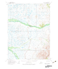
The Eek River meanders across this subarctic landscape during the mid-1950s, representing a time when much of the Alaskan interior remained unsurveyed and unmarked. Grounded in data from the Army Map Service, the map illustrates a complex network of waterways and drainage patterns, including the prominent Middle Fork Eek River. In the southeast, the topography rises sharply at Great Ridge, providing a significant landform contrast to the low-lying marshy areas and ponds that dominate the northern half of the quadrangle. The presence of the Base Line running through the center of the sheet indicates the foundational surveying work undertaken by the Bureau of Land Management to establish township and range locations in this wilderness territory before any formal road networks or settlements were established.
Find a feature on this map
4 named features on this map. Tap any name to fly to it.
Don’t see what you’re looking for? This feature index may not catch every label — zoom into the map to look around manually.
Map Details
Editions of this 1954 Bethel A-6 Map
2 editions found
Other maps of this area

1950 · Bethel
USGS Topo · 1:250,000

1951 · Goodnews
USGS Topo · 1:250,000

1954 · Bethel B-6
USGS Topo · 1:63,360

1954 · Bethel B-7
USGS Topo · 1:63,360

1954 · Bethel A-5
USGS Topo · 1:63,360

1954 · Bethel B-5
USGS Topo · 1:63,360

1954 · Bethel A-7
USGS Topo · 1:63,360

1954 · Goodnews D-6
USGS Topo · 1:63,360

1954 · Goodnews D-7
USGS Topo · 1:63,360

1954 · Goodnews D-5
USGS Topo · 1:63,360