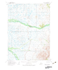
1954 Map of Bethel A-6
USGS Topo · Published 1983About this map
Eek River meanders across this subarctic landscape, providing the primary hydrological corridor through a terrain defined by countless small lakes and marshy lowlands. Based on aerial photography and field annotations from the mid-1950s, the map reveals a remote wilderness before significant infrastructure development. In the southern portion of the quadrangle, the elevation rises sharply toward the Great Ridge, where the complex drainage of the Middle Fork Eek River begins to carve through the uplands. This survey was produced during an era of extensive federal land management in Alaska, documented by the presence of a formal Base Line surveyed across the tundra to establish legal boundaries for the Bureau of Land Management.
Find a feature on this map
4 named features on this map. Tap any name to fly to it.
Don’t see what you’re looking for? This feature index may not catch every label — zoom into the map to look around manually.
Map Details
Editions of this 1954 Bethel A-6 Map
2 editions found

Other maps of this area

1950 · Bethel
USGS Topo · 1:250,000

1951 · Goodnews
USGS Topo · 1:250,000

1954 · Bethel B-6
USGS Topo · 1:63,360

1954 · Bethel B-7
USGS Topo · 1:63,360

1954 · Bethel A-5
USGS Topo · 1:63,360

1954 · Bethel B-5
USGS Topo · 1:63,360

1954 · Bethel A-7
USGS Topo · 1:63,360

1954 · Goodnews D-6
USGS Topo · 1:63,360

1954 · Goodnews D-7
USGS Topo · 1:63,360

1954 · Goodnews D-5
USGS Topo · 1:63,360