
1954 Map of Bethel A-7
USGS Topo · Published 1965About this map
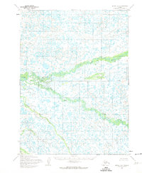
Eek River and the Middle Fork Eek River dominate this hydrologically complex landscape in the Bethel region, as documented by the Army Map Service in the mid-1950s. The map reveals an intricate network of countless unnamed tundra lakes and ponds, illustrating the saturated terrain characteristic of the Yukon-Kuskokwim Delta. Near the southern edge, the meandering courses of Ugaklik Creek and Kluktak Creek feed into the broader drainage system. A prominent surveyed Base Line cuts horizontally across the sheet, representing the early efforts of the Bureau of Land Management to establish land lines over unsurveyed territory. This topographic study reflects the era's reliance on photogrammetric methods from aerial photographs, capturing a snapshot of the Alaskan wilderness before significant infrastructure development.
Find a feature on this map
5 named features on this map. Tap any name to fly to it.
Don’t see what you’re looking for? This feature index may not catch every label — zoom into the map to look around manually.
Map Details
Editions of this 1954 Bethel A-7 Map
2 editions found
Other maps of this area

1950 · Bethel
USGS Topo · 1:250,000

1951 · Goodnews
USGS Topo · 1:250,000

1954 · Bethel B-6
USGS Topo · 1:63,360

1954 · Bethel B-7
USGS Topo · 1:63,360

1954 · Bethel B-8
USGS Topo · 1:63,360
1954 · Bethel A-8
USGS Topo · 1:63,360

1954 · Goodnews D-6
USGS Topo · 1:63,360

1954 · Goodnews D-7
USGS Topo · 1:63,360
1954 · Goodnews D-8
USGS Topo · 1:63,360

1954 · Bethel A-6
USGS Topo · 1:63,360