
1954 Map of Bethel B-7
USGS Topo · Published 1965About this map
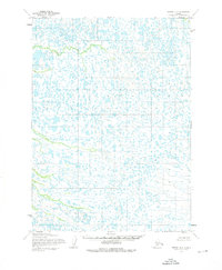
This remote stretch of the Alaska interior, documented through aerial photography in the early 1950s, reveals a complex landscape defined by thousands of unnamed lakes and marshy lowlands. The survey, conducted by the Army Map Service and published by the Geological Survey, captures the terrain just as the Bureau of Land Management was predetermining land lines for future township divisions. These unsurveyed boundaries, such as the line between R. 70 W. and R. 69 W., overlay a wilderness of intricate water patterns and shifting drainages. The map is a study in raw geography, devoid of roads, settlements, or established trails at the time of its field annotation. It serves as a foundational record of the Seward Meridian, showing the hydrographic density of the Yukon-Kuskokwim Delta region before modern development or formal infrastructure reached this specific quadrangle.
Find a feature on this map
4 named features on this map. Tap any name to fly to it.
Don’t see what you’re looking for? This feature index may not catch every label — zoom into the map to look around manually.
Map Details
Editions of this 1954 Bethel B-7 Map
2 editions found
Other maps of this area

1950 · Bethel
USGS Topo · 1:250,000

1954 · Bethel B-6
USGS Topo · 1:63,360

1954 · Bethel C-6
USGS Topo · 1:63,360

1954 · Bethel B-8
USGS Topo · 1:63,360

1954 · Bethel C-8
USGS Topo · 1:63,360
1954 · Bethel C-7
USGS Topo · 1:63,360
1954 · Bethel A-8
USGS Topo · 1:63,360

1954 · Bethel A-7
USGS Topo · 1:63,360

1954 · Bethel A-6
USGS Topo · 1:63,360
1964 · Bethel A-6
USGS Topo · 1:63,360